MAP SHEETS 14-16: Green Infrastructure Maps
MAP SHEETS 14-16: Green Infrastructure Maps
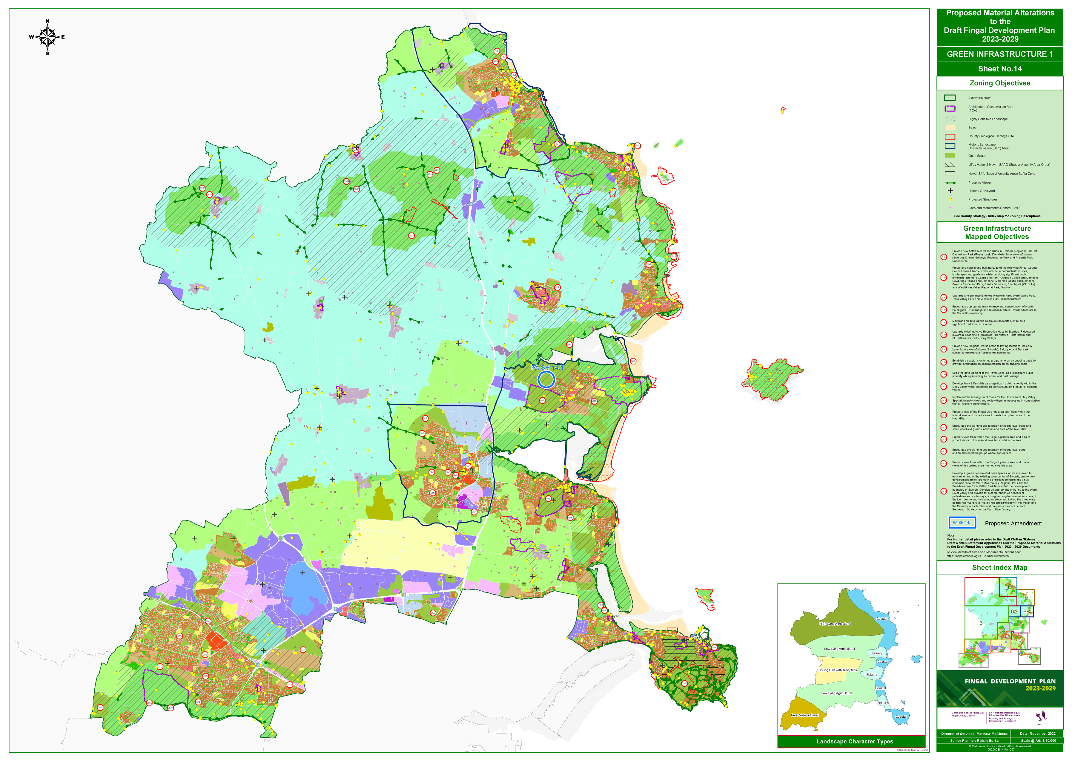
Map Sheet 14
[Click to enlarge and zoom]
[View interactive map]
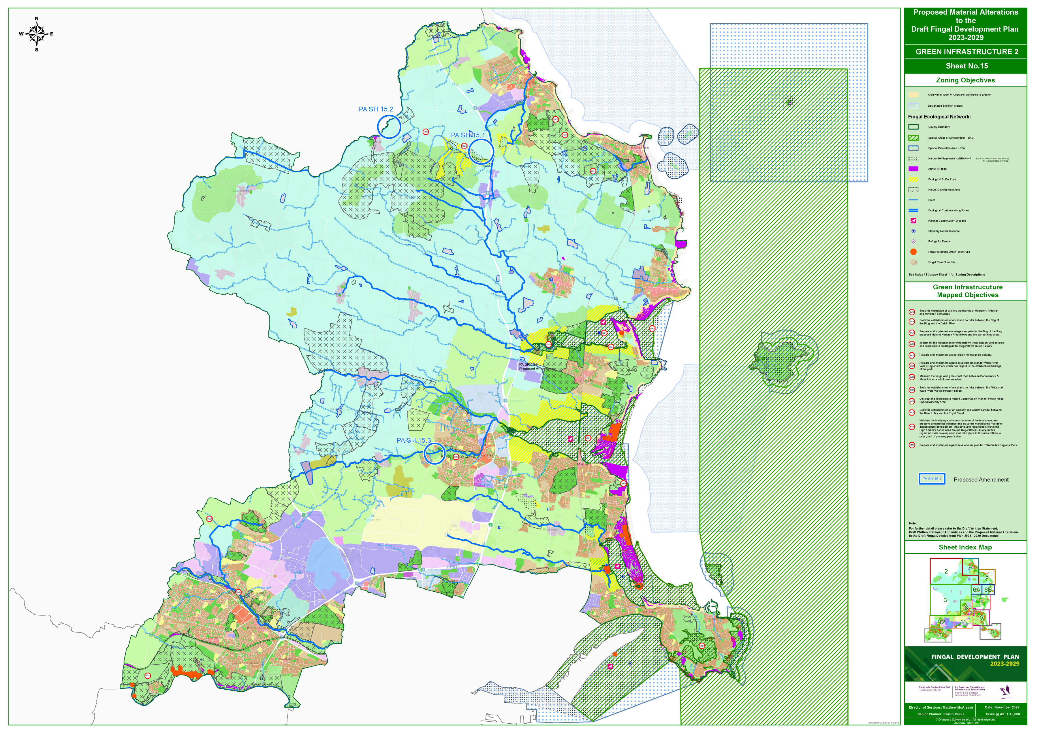
Map Sheet 15
There is a correction to this proposed material alteration. Please click HERE to view the correction.
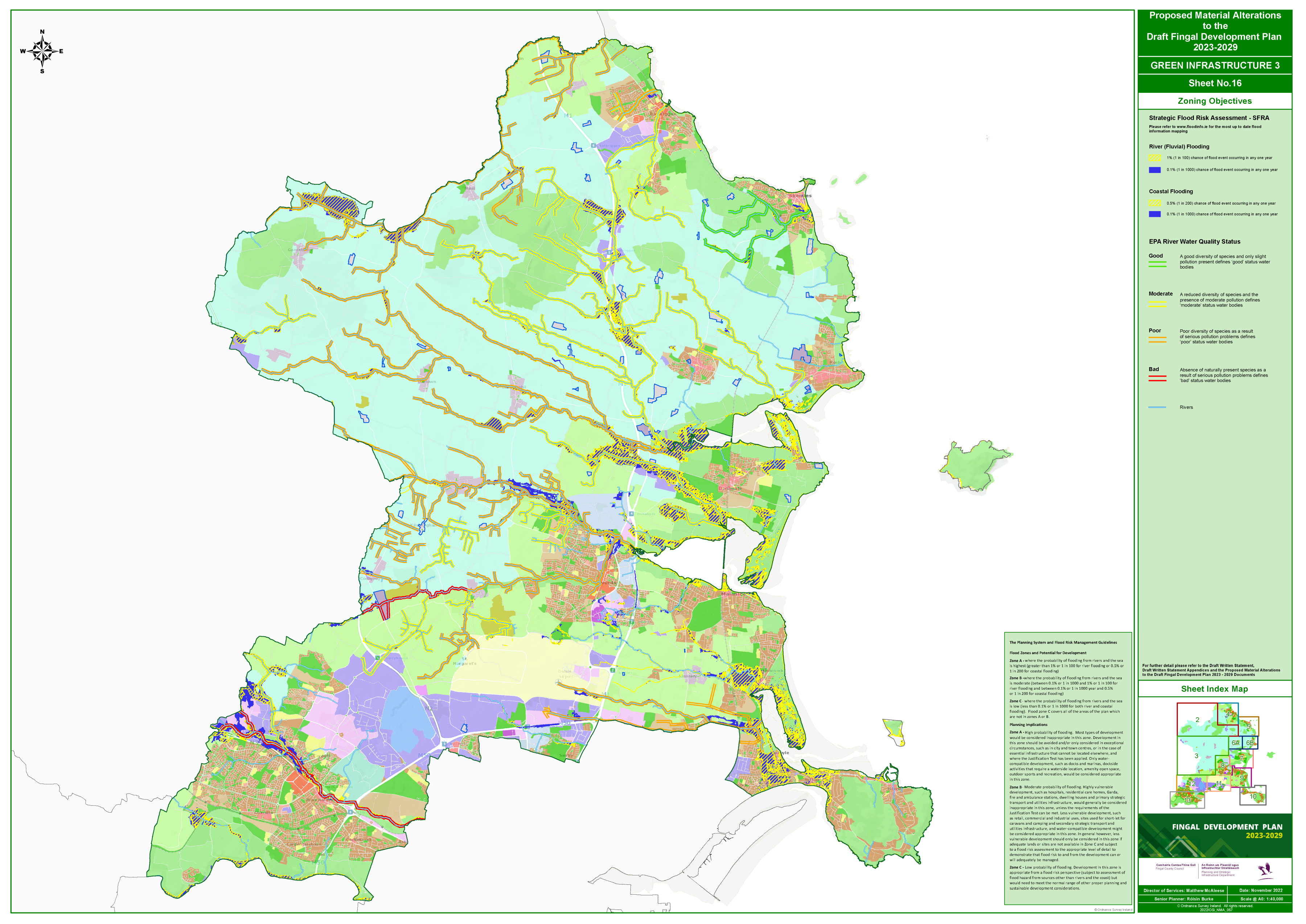
Map Sheet 16
 [Click to enlarge and zoom]
[View interactive map]
Proposed Amendments:
Click on the proposed amendment numbers below to view the map sheet for each proposed amendment.
PA SH 14.1:
Include a new Green Infrastructure mapped objective as follows:
Develop Nature Education Centre and Wildlife Hospital facility at Turvey Nature Park
PA SH 15.1:
Include a new Green Infrastructure mapped objective as follows:
Prepare and implement wetland and river restoration project for the Bog of the Ring and Matt River.
PA SH 15.2:
Include a new Green Infrastructure mapped objective as follows:
Prepare and implement wetland and river restoration project for Delvin River within the lifetime of this development plan in conjunction with local landowners and stakeholders. That as part of this project that FCC works in conjunction with Meath County Council and local landowners to address the issue of sewerage flowing into the Delvin River at Naul village.
PA SH 15.3:
Include new Green Infrastructure mapped objective (GIM 30) as follows:
Implement a strategy to establish a multi-function Green Infrastructure system, promoting an extensive Nature Based green corridor to meet challenges of Climate Change, linking to existing green infrastructure in a sensitive way to provide for community/public access and expand eco-tourism potential, including a greenway with connections to Swords town centre. To promote and enhance physical and visual connections with the Fingal Uplands area and local historic landscape characteristics, while protecting green areas and Bio-diversity