Chapter 9: Natural Heritage
9.1 Background
Our natural heritage includes the variety of life we see around us every day, often referred to as biodiversity, its physical or geological foundation, and the landscapes which form our surroundings. Biodiversity includes everything from trees to weeds, from mammals to birds, from coast to countryside. It is also an important part of the landscapes in which we live and which give each local area its sense of place. Protecting and enhancing our biodiversity and landscapes is vital for the health, well-being and quality of life of communities today and will also be vitally important in the future in adapting to climate change.
The County’s natural heritage is also a core component of Fingal’s Green Infrastructure (See Chapter 8). The Council’s approach to Green Infrastructure is one that seeks to conserve and enhance biodiversity and geological heritage and to promote the sustainable management of the landscape and coast.
Statement of Policy
- Conserve and enhance the County’s biodiversity
- Conserve and enhance the County’s geological heritage
- Promote a unified approach to landscape planning and management, provide an understanding of Fingal’s landscape in terms of its inherent and unique character and ensure that Fingal’s landscape is appropriately protected, managed and planned
- Protect, enhance and sustainably manage the coastline and its natural resources
|
Integrate provision for biodiversity with public open space provision and sustainable water management measures (including SuDS) where possible and appropriate. |
9.2 Biodiversity
Background
Ireland is a signatory to the worldwide Convention on Biological Diversity (CBD) and the Government is committed through this process to conserve and sustainably use biodiversity. The Convention aims, among other things, to secure a significant reduction in the current rate of loss of biodiversity. All parties to the Convention are required to develop national biodiversity strategies and action plans, and to integrate these into broader national plans. At EU level the most important habitats and species are protected through Natura 2000 which is the network of protected areas established under the Habitats and Birds Directives. In addition, member states are called on to develop and implement wider countryside measures in their land-use planning and development policies that support the coherence of the Natura 2000 network pursuant to Article 10 of the Habitats Directive and Article 3 of the Birds Directive. At national level biodiversity policy is set out in the National Biodiversity Plan (NBP) which identifies habitat degradation and loss as the main factor eroding biodiversity in Ireland today. The spread of invasive species is also a growing problem (see www.invasivespeciesireland.com for further information) and prohibitions are in place in relation to the introduction or dispersal of certain invasive species as set out in the Third Schedule of the European Communities (Birds and Habitats Regulations 2011 (S.I. 477/2011). Many of the policy provisions of the NBP are given effect through the legislative framework provided by the Wildlife Acts 1976-2000 and through the implementation of the Habitats Directive, the Birds Directive and the Water Framework Directive. Among other things, the NBP calls on local authorities to prepare and implement local biodiversity plans to provide for the conservation and sustainable use of biodiversity at local level.
|
Implement the Fingal Biodiversity Action Plan 2015 and any revisions thereof in partnership with all relevant stakeholders. |
|
Undertake necessary ecological surveys and complete habitat mapping for the County during the lifetime of the Plan, prioritising sensitive coastal areas. |
|
Raise awareness in relation to biodiversity across the community. |
It is important that all development proposals include measures to protect and enhance biodiversity. This will be achieved through the Development Management process and reference should be made to Chapter 12 Development Management Standards – Section 12.12 Natural Heritage.
|
Actively support the aims and objectives of the All Ireland Pollinator Plan 2015-2020 by encouraging bee keeping and other measures to protect and increase the population of bees and other pollinating insects in Fingal. |
|
Ensure that the management of the Council’s open spaces and parks is pollinator-friendly, provides more opportunities for biodiversity, and does not introduce or lead to the spread of invasive species. |
|
Support the National Parks and Wildlife Service, Department of Arts, Heritage and the Gaeltacht, in the maintenance and, as appropriate, the achievement of favourable conservation status for the habitats and species in Fingal to which the Habitats Directive applies. |
|
Ensure that the Council takes full account of the requirements of the Habitats and Birds Directives, as they apply both within and without European Sites in the performance of its functions. |
|
Ensure that the Council, in the performance of its functions, takes full account of the objectives and management practices proposed in any management or related plans for European Sites in and adjacent to Fingal published by the Department of Arts, Heritage and the Gaeltacht. |
|
Undertake field studies and map invasive species throughout the County and initiate control programs with all relevant stakeholders and landowners to control the key invasive species. |
|
Ensure that proposals for development do not lead to the spread or introduction of invasive species. If developments are proposed on sites where invasive species are or were previously present, the applicants will be required to submit a control and management program for the particular invasive species as part of the planning process and to comply with the provisions of the European Communities Birds and Habitats Regulations 2011 (S.I. 477/2011). |
|
Protect inland fisheries within and adjacent to Fingal and take full account of Inland Fisheries Ireland Guidelines in this regard when undertaking, approving or authorising development or works which may impact on rivers, streams and watercourses and their associated habitats and species. |
Biodiversity Conservation in Fingal
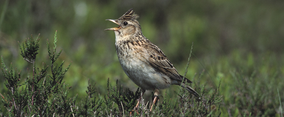
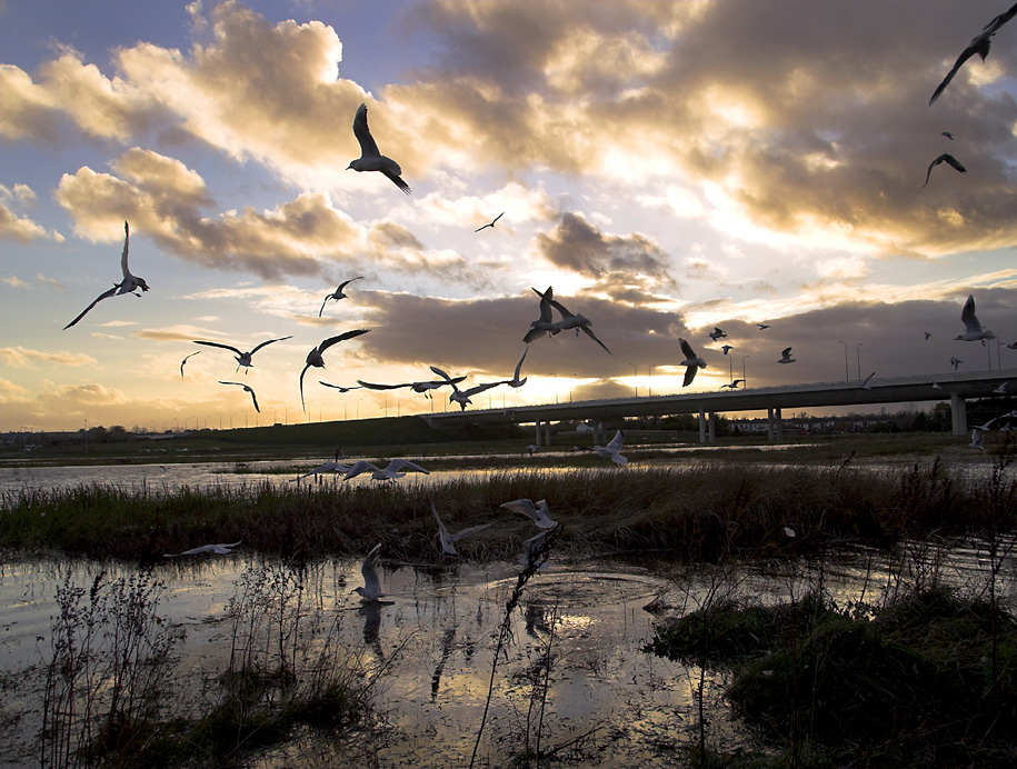
Fingal hosts a wealth of wildlife including a range of threatened habitats and species which are protected by law. The most important sites for wildlife can be found along the coast. Baldoyle, Malahide and Rogerstown estuaries and the islands off the Fingal coast host a range of important habitats and species as well as being home to thousands of breeding and migratory birds. The Rockabill to Dalkey Island marine SAC is located off the Fingal coast and was designated for the underwater reefs and as a habitat for Harbour Porpoise. In addition to the coastal sites, two wetland sites in Fingal (Sluice River Marsh and the Bog of the Ring) are proposed for designation as Natural Heritage Areas (NHA) under national wildlife legislation.
The occurrence of protected flora and fauna species is not confined to protected sites. Protected birds, bats, otters and badgers for example are frequently found in the wider countryside, together with a wide range of common plants and animals which are all part of the interrelated natural fabric of the landscape. Rivers and streams are home to a variety of habitats and species, including fish. They function as ecological "corridors" which enable species to move from place to place. Wetlands associated with rivers and streams, such as wet grasslands and marshes, also provide many benefits. These ecological "stepping-stones" enable wetland species to move through the landscape.
Over the past 50 years land-use change associated with agriculture, roads, housing and recreation has led to increased habitat loss, habitat degradation and fragmentation. It is therefore vital that as land is developed, we protect the designated sites and their surrounding lands and that we enable biodiversity in the wider landscape to be maintained and enhanced. If biodiversity in the wider landscape is not maintained, the long-term viability of the habitats and species in the protected areas themselves will be called into question.
To this end, Fingal County Council has developed the Fingal Biodiversity Action Plan which sets out the Council’s objectives for biodiversity conservation for the next 20 years. A major element of the Fingal Biodiversity Action Plan is the development of the Fingal Ecological Network.
The Fingal Ecological Network sets out a spatial framework for biodiversity conservation and management in Fingal. The ecological network consists of the following elements (See Green Infrastructure Maps):
- Core Biodiversity Conservation Sites
- Ecological Buffer Zones
- Nature Development Areas
- Ecological Corridors and Stepping Stones Including Trees and Hedgerows
The approach is primarily based on strictly protecting the most important biodiversity conservation areas in the County as required by law, including the identification and protection of ecological buffer zones around these areas, providing opportunities for nature through the development of conservation initiatives in nature development areas and by protecting important movement corridors and stepping stones for wildlife in the landscape. Throughout Europe and further afield similar ecological networks are being established to integrate biodiversity conservation and management with spatial planning and other sectoral plans and programmes. This approach is also likely to be beneficial in increasing the ability of wildlife to adapt to the impacts of climate change. Making space for biodiversity, and increasing the permeability and connectivity of today’s landscapes for wildlife, increases the opportunities for biodiversity to adapt as the climate changes while at the same time providing many immediate benefits to society and the economy.
Core Biodiversity Conservation Areas
The most important nature conservation sites make up the core biodiversity conservation areas. These include internationally and nationally designated sites hosting habitats listed in Annex I of the Habitats Directive and sites hosting rare and protected species and their habitats.
Protected Areas of International Importance: Natura 2000
A range of protected areas have been (or will be) designated under national and EU legislation and under the Ramsar Convention on wetlands. Special Areas of Conservation (SACs) and Special Protection Areas (SPAs) are being or have been, designated to conserve habitats and species of European importance pursuant to the EU Habitats and Birds Directives. These sites are part of a pan-European network known as Natura 2000 (See Table BD01). The boundaries of the protected areas may change during the lifetime of the Plan and additional areas may be designated. The National Parks and Wildlife Service website provides up-to-date information regarding these sites (www.npws.ie).
Appropriate Assessment
Article 6 of the Habitats Directive requires that the impacts of any plans or projects likely to affect Natura 2000 sites are assessed by the Planning Authority. This process is known as Appropriate Assessment. Appropriate Assessment means an assessment, based on best scientific knowledge, of the potential impacts of a plan or project, wherever located, on the conservation objectives of any Natura 2000 site and the development, where necessary, of mitigation or avoidance measures to preclude negative effects. The impacts assessed must include the direct, the indirect and cumulative impacts of approving the plan or project. While the responsibility for carrying out appropriate assessment lies with the planning authority, applicants for planning permission must provide sufficient information with a planning application to enable the authority to complete the screening process and full appropriate assessment if screening cannot exclude significant effects on Natura 2000 sites. For projects requiring full appropriate assessment it is the responsibility of the project proponents to have a Natura Impact Statement (NIS) prepared for submission to the planning authority as part of the planning application. To ensure that Appropriate Assessments are based on best scientific knowledge, those compiling information for Appropriate Assessment Screening and those preparing Natura Impact Statements must have sufficient expertise and experience in relation to the ecological or other (e.g. hydrological) issues concerned and disclose an appropriate regard for the latest and most appropriate scientific methodology and assessment procedures. Those compiling information for Appropriate Assessment Screening and those preparing Natura Impact Statements should consult the Guidance issued by the Department of the Environment, Heritage and Local Government (Appropriate Assessment of Plans and Projects in Ireland – Guidance for Planning Authorities, 2009) and relevant EPA and EU Guidance documents. Where full Appropriate Assessment is required for a project the need for an EIS must also be formally considered by the planning authority. For plans (including Local Area Plans & Development Plan) which require a full Appropriate Assessment, Strategic Environmental Assessment (SEA) must also be carried out.
The Council will consult with the Prescribed Bodies, and other Government agencies where appropriate, when considering plans or projects which are likely to affect Natura 2000 sites (or those sites proposed to be designated as Natura 2000 sites). In accordance with Article 6(3) of the Habitats Directive the Council will normally only grant permission in cases where it is clearly demonstrated that a proposed development, either individually or in combination with other plans and projects, will not adversely affect the ecological integrity of a Natura 2000 site or sites. Following a finding that a proposed development will adversely affect the integrity of a Natura 2000 site, planning permission may only be granted in exceptional cases, in the absence of any alternatives, for imperative reasons of over-riding public interest subject to the strict requirements of Article 6(4) of the Habitats Directive.
|
Strictly protect areas designated or proposed to be designated as Natura 2000 sites (i.e. Special Areas of Conservation (SACs) and Special Protection Areas (SPAs); also known as European sites) including any areas that may be proposed for designation or designated during the period of this Plan. |
Table BD01: Protected Areas of International and National Importance [1]
|
Location |
SAC |
SPA |
pNHA |
NHA |
WFDRPA |
Ramsar |
SNR |
RFF |
|---|---|---|---|---|---|---|---|---|
|
Baldoyle Bay |
P |
P |
P |
P |
P |
P |
||
|
North Bull Island |
P |
P |
P |
P |
||||
|
Bog of the Ring |
P |
P |
||||||
|
Feltrim Hill |
P |
P |
||||||
|
Howth Head |
P |
P |
P |
P |
||||
|
Ireland's Eye |
P |
P |
P |
P |
||||
|
Lambay Island |
P |
P |
P |
P |
||||
|
Knock Lake |
P |
P |
||||||
|
Liffey Valley |
P |
P |
||||||
|
Loughshinny Coast |
P |
P |
||||||
|
Malahide/Swords |
||||||||
|
/Broadmeadow Estuary |
P |
P |
P |
P |
P |
|||
|
North Dublin Bay |
P |
P |
P |
|||||
|
Portraine Shore |
P |
P |
||||||
|
Rockabill Island |
P |
P |
P |
P |
||||
|
Rockabill to Dalkey |
P |
|||||||
|
Rogerstown Estuary |
P |
P |
P |
P |
P |
P |
||
|
Royal Canal |
P |
P |
||||||
|
Santry Demesne |
P |
P |
||||||
|
Skerries Islands |
P |
P |
P |
|||||
|
Sluice River Marsh |
P |
P |
SAC = Special Area of Conservation
SPA = Special Protection Area
pNHA = proposed Natural Heritage Area
NHA = Natural Heritage Area
WFDRPA = Water Framework Directive Register of Protected Areas site
Ramsar = site designated pursuant to Ramsar Convention on Wetlands
SNR = Statutory Nature Reserve
RFF = Refuge for Fauna
Protected Areas of National Importance
Under the Wildlife (Amendment) Act, 2000 Natural Heritage Areas (NHAs) are being designated to conserve species and habitats of national importance. This includes the Liffey Valley, Royal Canal and wetland sites such as the Sluice River Marsh and the Bog of the Ring. There are also a number of Statutory Nature Reserves and Refuges for Fauna in Fingal. These areas, established under the Wildlife Acts 1976 and 2000, are areas where nature conservation is the primary objective and takes precedence over all other activities. The Council will normally only grant permission where it is clearly demonstrated that a proposal will have no significant adverse impact on the habitats and species of interest in the designated area and its ecological integrity.
Habitat Areas Listed on Annex I of the Habitats Directive Located Outside Designated Areas
A number of areas hosting habitats listed in Annex I of the Habitats Directive but outside Special Areas of Conservation (SACs) have been identified in the County (see Green Infrastructure maps). These include sand-dunes, shingle and gravel banks and shores, orchid rich grasslands, petrifying springs, and vegetated sea cliffs. The majority of these habitats are found along the coast. Some of these habitats are also important for coastal defence. The Council will normally only grant planning permission where it is clearly demonstrated that a proposal will have no significant adverse impact on the habitats of interest in these areas and their ecological integrity.
Rare and Protected Species and their Habitats
See also Green Infrastructure maps and Fingal Biodiversity Action Plan
Certain plant, animal and bird species are rare and threatened. This includes nationally rare plants which occur in Fingal, plants listed in the Red Data Lists of Irish Plants, Flora (Protection) Order 2015 (or other such Orders) and their habitats, birds listed in Annex I of the Birds Directive, and animals and birds listed in the Wildlife Act, 1976 and subsequent statutory instruments. Many of these species are protected by law. In addition, strict protection under the Habitats Directive applies to the species listed in Annex IV of that Directive, including all bat species, the otter, and all cetaceans. Where Annex IV species are present, all possible measures to avoid damage and disturbance to them must be taken in the formulation of proposals for development. Where the risk of damage or disturbance is unavoidable, an application for a derogation licence may be made to the Minister for Arts, Heritage and the Gaeltacht under Regulation 54 or 55 of the European Communities (Birds and Natural Habitats) Regulations 2011 (S.I. 477/2011). The derogation license should be obtained in advance of seeking planning permission for a proposed development.
The planning process will seek to protect rare and threatened species, including species protected by law and their habitats. Applicants must demonstrate that proposals will not have a significant adverse impact on such species and their habitats. This can often be done by avoiding adverse impacts, for example, by redesigning the proposed development to exclude impacts on protected species and their habitats or by ensuring that development takes place outside the breeding season. In some cases, it may be appropriate to provide alternative roosts (for bats, for example), or to provide suitable habitat elsewhere. In some cases it may be necessary to re-locate the proposed development.
Consultation with the Prescribed Bodies, and appropriate Government agencies, will take place when considering undertaking, approving or authorising development which is likely to affect species listed in Annex IV of the Habitats Directive, Annex I of the Birds Directive or the Flora Protection Order. In the case of species listed in Annex IV of the Habitats Directive, applications for planning permission must be accompanied by a copy of the derogation licence issued by the Minister for Arts, Heritage and the Gaeltacht. The Planning Authority will take account of the views of the Prescribed Bodies and any licensing requirements in relation to protected species. An ecological impact assessment will be required for any proposed development likely to have a significant impact on rare and threatened species including species protected by law and their habitats. The Council will normally only grant planning permission where it is clearly demonstrated that a proposal will have no significant adverse impact, incapable of satisfactory avoidance or mitigation, on the species of interest and associated habitat(s).
|
Protect the ecological integrity of proposed Natural Heritage Areas (pNHAs), Natural Heritage Areas (NHAs), Statutory Nature Reserves, Refuges for Fauna, and Habitat Directive Annex I sites. |
|
Ensure that development does not have a significant adverse impact on proposed Natural Heritage Areas (pNHAs), Natural Heritage Areas (NHAs), Statutory Nature Reserves, Refuges for Fauna, Habitat Directive Annex I sites and Annex II species contained therein, and on rare and threatened species including those protected by law and their habitats. |
Ecological Buffer Zones
The Council has identified lands around Malahide/Broadmeadow, Rogerstown and Baldoyle estuaries and around Sluice River Marsh and the Bog of the Ring as ecological buffer zones. These buffer zones protect the ecological integrity of the nationally and internationally designated sites by providing suitable habitat for key species such as birds, by providing for compatible land-uses around the designated sites, and in the case of the freshwater wetland areas, by ensuring a steady supply of clean groundwater and surface water. Around the estuaries the buffer zones can also provide for recreational uses and are also important for coastal flood protection and for climate change adaptation. Ecological buffer zones are areas where agricultural uses may be combined with nature conservation and low-intensity recreational use such as walking and cycling. The Council will normally only grant permission where it is clearly demonstrated that a proposal will have no significant adverse impact on the habitats and species of interest in the buffer zone and its ecological functions. Proposals for development in these areas will require Appropriate Assessment because of their close proximity to Natura 2000 sites.
|
Protect the functions of the ecological buffer zones and ensure proposals for development have no significant adverse impact on the habitats and species of interest located therein. |
|
Develop Ecological Masterplans for the Rogerstown, Malahide and Baldoyle Estuaries focusing on their ecological protection and that of their surrounding buffer zones. |
Nature Development Areas
Populations of many typical plants and animals of the wider countryside are declining as a result of the loss of wildlife friendly features such as hedgerows, flower-rich grasslands, uncultivated margins of arable fields and wetland areas. In addition, woodlands in Fingal are generally small
and scattered throughout the County. The Council has identified a number of areas and land-uses in the County with potential for biodiversity enhancement (see Green Infrastructure Maps). These include:
- Farmland Areas
- Demesnes
- Golf courses
- Parkland
- Quarries
- Waterbodies
- Areas suitable for new woodland or forestry
These areas, which are referred to as ‘nature development areas’, are locations where nature conservation can be combined with existing activities such as farming, forestry, quarrying and recreation (e.g. golf courses). The areas and land-uses have been selected because of their existing or potential value for wildlife. The nature development areas are reservoirs of biodiversity in the wider countryside and together with the corridors and stepping stones allow species to move through the landscape. Specific objectives have been developed for the nature development areas in the Fingal Biodiversity Action Plan and the Council will work with landowners to achieve benefits for biodiversity in these areas. From a planning perspective, the Council aims to ensure that the biodiversity value of these areas is maintained and enhanced. Applications for planning permission must demonstrate how the proposed development will maintain and enhance the biodiversity value of the site.
|
Maintain and/or enhance the biodiversity of the nature development areas indicated on the Green Infrastructure maps. |
|
Develop a demonstration site for each nature development area. |
|
Explore the development of a small grants scheme to assist landowners with the management of their lands within the ecological network for nature conservation purposes. |
Ecological Corridors and Stepping Stones Including Trees and Hedgerow
Ecological corridors are linear landscape features such as rivers, hedgerows and road verges that enhance the movement of wildlife through the landscape. Stepping stones comprise a series of smaller landscape features such as small woodlands, areas of scrub, wet grassland and marshes. The key corridors in Fingal are along the major rivers, including their floodplains and the adjacent farmland or parkland. The Liffey, Tolka, Ward, Broadmeadow, Ballyboghil, Corduff and Sluice rivers and their tributaries, are salmonid systems (designated pursuant to Directive 78/659/EEC) and are therefore of particular significance. The Liffey and several of its tributaries are exceptional in supporting Atlantic Salmon (listed in Annex II of the Habitats Directive), Sea Trout and Brown Trout populations. To be ecologically effective corridors need to be a minimum of 30m in width measured from the top of each riverbank. This width allows many species associated with rivers such as the Otter, Bats, Kingfisher, and Dipper, together with the aquatic species in the rivers such as Salmon, Sea Trout, Brown Trout and Lamprey to thrive. Because of their importance all rivers and streams will be maintained in an open semi-natural condition, wherever possible. Their corridors and valleys will be protected and maintained for their biodiversity and landscape values, including flood protection.
The Council will normally only grant planning permission where it is clearly demonstrated that a proposal will not adversely affect the habitats and/or species of interest in the corridor or stepping stone or compromise its function as an ecological corridor or stepping stone. Proposals for development affecting these areas should also seek to enhance the ecological values of the corridor or stepping stone as an integral part of the proposal. An ecological assessment may be required for any proposed development likely to have a significant impact on habitats and species of interest in an ecological corridor or stepping stone.
The Council will consult Inland Fisheries Ireland and, where appropriate, the National Parks and Wildlife Service (NPWS) prior to undertaking, approving or authorising any works or development which may impact on rivers, streams and watercourses. The Council will take full account of any Guidance documents issued by Inland Fisheries Ireland in this regard.
|
Protect the ecological functions and integrity of the corridors indicated on the Development Plan Green Infrastructure maps. |
|
Protect rivers, streams and other watercourses and maintain them in an open state capable of providing suitable habitat for fauna and flora, including fish. |
|
Provide for public understanding of and public access to rivers, waterway corridors and wetlands, where feasible and appropriate, in partnership with the National Parks and Wildlife Service, Waterways Ireland and other relevant stakeholders, while maintaining them free from inappropriate development and subject to ecological impact assessment and Screening for Appropriate Assessment as appropriate. |
|
Promote the use of watercourses, rivers and lakes for the pursuit of angling, through working with Inland Fisheries Ireland to improve water quality, to improve fish stocks and to provide safe access to fishing, where appropriate, taking full account of the requirements of the Habitats Directive and other relevant legislation. |
|
Protect existing woodlands, trees and hedgerows which are of amenity or biodiversity value and/or contribute to landscape character and ensure that proper provision is made for their protection and management. |
|
Consider the use of Tree Preservation Orders to protect important trees, groups of trees or woodlands. |
|
Promote, encourage and support Neighbourwood Schemes by identifying suitable areas and support other initiatives that aim to establish and enhance woodlands for recreational purposes in partnership with local communities. |
9.3 Geology
County Geological Sites
The Geological Survey of Ireland (GSI) has identified 21 County Geological Sites in Fingal which are important geological heritage sites. Some of these sites may be designated, in due course, as National Heritage Areas (NHAs) because of their geological interest from a national perspective. The Council will seek to maintain and where possible enhance the geological heritage of these sites and to provide access to these sites where possible and appropriate. The Council will consult the Geological Survey of Ireland when considering undertaking, approving or authorising developments which are likely to affect County Geological Sites.
|
Protect and enhance the geological and geomorphological heritage of the County Geological Sites listed in Table GH01 and indicated on Green Infrastructure maps. |
|
Protect and promote safe and sustainable public access to County Geological Sites where appropriate and feasible subject to the requirements of Article 6 of the Habitats Directive. |
Table GH01: County Geological Sites
|
Site Name |
|
|---|---|
|
1. Ardgillan House Boulder 2. Balrickard Quarry 3. Balscadden Bay 4. Bottle Quay 5. Claremont Strand 6. Curkeen Hill Quarry 7. Fancourt Shore 8. Feltrim Quarry 9. Hill of Howth 10. Ireland’s Eye 11. Lambay Island |
12. Malahide Coast 13. Malahide Point 14. Milverton Quarry 15. Mulhuddart (Lady’s) Well 16. Nags Head Quarry 17. Portraine Shore 18. Rockabill 19. Shenick’s Island 20. Skerries to Rush Coastline 21. Walshestown Stream Section |
9.4 Landscape
See also Green Infrastructure Maps and Chapter 5 Rural Fingal – Layout and Design for Housing in the Countryside.
Background
Landscape is all around us – it’s where we live, work and play – enriching and sustaining our lives in countless ways. All aspects of our natural and cultural heritage come together in these landscapes and give us a strong sense of place. In Fingal our coast and countryside are a particular source of pride and inspiration for many residents and visitors alike. Fingal is changing rapidly as a result of high rates of economic and population growth. The challenge we face is to manage our landscapes so that change is positive in its effects, and that the landscapes which we value are protected and those which have been degraded are enhanced.
The European Landscape Convention which Ireland ratified in 2002 forms the basis for inclusive and participative landscape management. It defines landscape as ‘…an area, as perceived by people, whose character is the result of the action and interaction of natural and/or human factors’ and this definition has been incorporated into the Planning and Development Acts, as amended. The Convention requires landscape to be integrated into regional and town planning policies and in cultural, environmental, agricultural, social and economic policies, as well as any other policies with possible direct and indirect impacts on landscape. In addition to obvious environmental benefits from properly protecting, managing and planning landscape, the Convention highlights the economic and social benefits that accrue such as tourism potential, economic growth, employment and quality of life enhancement. The implementation of the recently published National Landscape Strategy 2015-2025 will ensure compliance with the European Landscape Convention in Ireland.
The Planning and Development Acts, as amended, require that development plans include objectives in relation to landscape and its management, including the preservation of views and prospects and the amenities of places and features of natural beauty or interest. The Regional Planning Guidelines for the Greater Dublin Area 2010 – 2022 state that policies and measures should be adopted at county level to protect, manage and plan landscapes.
|
Support the aims and objectives of the European Landscape Convention by implementing the relevant objectives and actions of the National Landscape Strategy 2015-2025. |
Landscape Character Assessment
The Development Plan’s Landscape Character Assessment (LCA) provides for the classification of Fingal’s landscapes into the following (1) types and values and (2) sensitivities. The LCA divides the County into 6 Landscape Character Types representing generic areas of distinctive character that makes one landscape different from another such as uplands or the coast. The LCA places a value on each landscape character type ranging from exceptional to low. Subsequent to the type and value being identified, the sensitivity of each character type is defined as its overall ability to sustain its character in the face of change. Sensitivity is evaluated using criteria ranging from high to low. A highly sensitive landscape is likely to be vulnerable to change whereas a landscape with a low sensitivity is likely to be less at risk from change. It is important to note that it does not necessarily follow that an exceptional value landscape will be highly sensitive to change or similarly a low value landscape will have a low sensitivity to change. The LCA will inform decision making in relation to the protection of the environment, natural resources and heritage and will be used to guide development.
Of the 6 Landscape Character Types identified in the LCA for Fingal each is given a value through the consideration of such elements as aesthetics, ecology, historical, cultural, religious or mythological. A value can range from low to exceptional. The Landscape Character Types are:
- Rolling Hills Character Type
- High Lying Character Type
- Low Lying Character Type
- Estuary Character Type
- Coastal Character Type
- River Valleys and Canal Character Type
Rolling Hills Character Type
This area of Fingal is mainly agricultural land characterised by rolling landscapes across the Ward and Broadmeadow river valleys. The undulating nature of the countryside together with the presence of larger properties and tree belts has resulted in a varied landscape. The trees together with the river corridors help create a rich landscape, both visually and ecologically. Views are generally contained by the rolling landscape, which creates a landscape of short horizons. There are protected views which are listed in the Development Plan from the R108 (St Margaret’s to Naul road) and R125 (Swords to Ashbourne road). Swords is the main settlement within this area.
The Rolling Hills Character Type is made up principally of agricultural land and is of value due to the Ward and Broadmeadow rivers and the ecological and visual attributes they bring. The protected views, tree belts and undulating lands also add value to the area. An important quality is the archaeological heritage in Swords. The Rolling Hills Character Type is categorised as having a modest value.
High Lying Character Type
This is an area of upland, rising to a high point of 176 metres at Hillfort Mound, to the south east of the Naul. These hills afford panoramic views of the Mourne Mountains to the north, the coastline to the east and the Wicklow Mountains to the south. There are a number of important visual ridges on these uplands, which are visible over a wide area of Fingal and Meath. Almost the whole County can be seen from the more elevated roads. The character of the uplands is very attractive with a mixture of pasture and arable farming combined with strong hedgerows in a rolling landscape.
The High Lying Character Type is categorised as having a high value. The elevated area is very scenic, with panoramic views and strong hedgerows. It also has an important ecological value particularly as the ‘Bog of the Ring’ proposed Natural Heritage Areas is situated here. There is little obtrusive or inappropriate development in the area and there is a pronounced absence of any substantial coniferous woodland. The area’s importance is highlighted by the High Amenity zoning covering substantial parts of the area.
Low Lying Character Type
This is an area characterised by a mix of pasture and arable farming on low lying land with few protected views or prospects. The Low Lying Character Type has an open character combined with large field patterns, few tree belts and low roadside hedges. The main settlements located within the area include Oldtown, Ballyboghill and Lusk and parts of Malahide and Donabate. Dublin Airport is located in this area.
This low lying area is dominated by agriculture and a number of settlements. The area is categorised as having a modest value. It contains pockets of important value areas requiring particular attention such as important archaeological monuments and demesnes and also the Feltrim Hill and Santry Demesne proposed Natural Heritage Areas.
Estuary Character Type
Along the coast of Fingal there are three large sand spits which have created protected estuarine and saltmarsh habitats of great ornithological and ecological interest at Rogerstown, Swords/Malahide and Baldoyle. The three estuaries are Natura 2000 Sites (Special Protection Areas and Special Areas of Conservation).
The estuaries are also designated proposed Natural Heritage Areas and Ramsar sites. The margins of the estuaries are generally free of development with the exception of Malahide along the south side of the Swords/Malahide estuary. The flat horizontal nature of estuaries means that views are generally contained within the low hills and dunes that enclose these areas. There are some groups of trees to the edges of the estuary zones especially to the north side of the Swords/Malahide estuary. The character of these zones can alter depending on the tidal condition.
Also located within this zone is The Burrow in Portrane. Haphazard development, poor access roads, untidy boundaries and indistinct access points to sites distinguish this area. Due to the tradition of seasonal occupation and haphazard extensions to temporary homes, a poor settlement pattern has developed with little relationship to the surrounding landscape.
The Estuary Character Type is categorised as having an exceptional value, recognised by the EU designations (candidate Special Areas of Conservation and Special Protection Areas) that apply to each in addition to national designations such as proposed Natural Heritage Areas and Ramsar. The aesthetic quality of the estuaries is also outstanding.
Coastal Character Type
The Coastal Character Type forms the eastern boundary of the County and contains a number of important beaches, islands and headlands that together create a landscape of high amenity and landscape value. A number of important settlements are located within this area, including Balbriggan, Skerries, Rush, Malahide, Portmarnock and Howth. The land is generally low lying, with the exception of some prominent headlands and hills in the northern part of the area, Howth and the offshore islands. Most of the Howth peninsula is covered by the 1999 Special Amenity Area Order (SAAO).
There are a number of important demesne or estate landscapes containing important woodlands in or adjoining this area at Ardgillan, Hampton, Milverton and Portrane. Horticulture (around Rush), golf courses and individual dwellings are prevalent land uses in the area also. Views along the coast are generally contained within headlands, ridgelines and harbours, creating a number of visual compartments.
The Coastal Character Type is categorised as having an exceptional landscape value. This value is arrived at due to the combination of visual, ecological, recreational and historical attributes. The area has magnificent views out to sea, to the islands and to the Mourne and Wicklow mountains and contains numerous beaches and harbours. The area’s importance is highlighted by the High Amenity zoning covering substantial parts of the area. The area is rich in archaeological, architectural and natural heritage and is of high ecological value.
River Valleys and Canal Character Type
The Tolka and Liffey valleys together with the Royal Canal Corridor are the main landscape features in this area. The Tolka and Liffey valleys are characterised by areas of grassland along meandering river valleys which, especially in the case of the Liffey, are well wooded at the edge of the floodplain and along the valley slopes. Areas of both valleys support recreational facilities along their corridors.
A number of institutional and private demesnes along the valley edges maintain a rural and wooded character to the areas. However, housing estates are beginning to encroach into corridor areas. In recognition of the special amenity value of this area a Special Amenity Area Order was made for the Liffey Valley between Lucan and Chapelizod in 1990. This designation includes specific controls over development. The River Liffey is also a proposed Natural Heritage Area (pNHA).
The Royal Canal corridor is also included in this zone. The canal and its corridor provide valuable habitat for fish and other species and is a proposed NHA. The canal itself and the many bridges and other structures associated with it are an integral part of the County’s architectural heritage.
This Character Type is categorised as having a high value, due to the visual and recreation qualities contained therein. This is evident by virtue of the High Amenity zoning and Special Amenity Area designation in the area in addition to the dense tree belts and steep river valley slopes. The river valleys and the canal are also important for their ecology and biodiversity.
Landscape Character Types - Sensitivity
Where a wide range of developments would sit comfortably in a particular landscape and would not interfere with a character or interfere or eliminate a value, such a landscape is deemed to be of low to medium sensitivity. On the other hand, where any proposed development would seriously damage a character or eliminate or seriously damage an irreplaceable value, such a landscape would be considered to be highly sensitive.
Low to Medium Sensitive Character Types
The following two character types are categorised as having a low to medium sensitivity to development, namely:
- Rolling Hills Character Type – medium sensitivity
- Low Lying Character Type – low sensitivity
These landscapes can absorb a certain amount of development once the scale and forms are kept simple and surrounded by adequate screen boundaries and appropriate landscaping to reduce impact on the rural character of the surrounding roads. The protection of views and riparian corridors from inappropriate development is of paramount importance in these areas.
Principles for Development
- The skyline should be protected.
- Existing tree belts should be retained and managed and older stands of trees restocked. Roadside hedging should be retained and managed. Proposals necessitating the removal of extensive field and roadside hedgerows or trees should not be permitted. Strong planting schemes using native species, to integrate development into these open landscapes, will be required.
- Establish riparian corridors free from new development along all significant watercourses in the County. Ensure a 10 to 15 metre wide riparian buffer strip measured from top of bank either side of all watercourses, except in respect of the Liffey, Tolka, Pinkeen, Mayne, Sluice, Ward, Broadmeadow, Corduff, Matt and Delvin where a 30m wide riparian buffer strip from top of bank to either side of all watercourses outside urban centres is required.
- Sites with natural boundaries should be chosen, rather than open parts of larger fields.
- Clustering with existing farmhouse and/or farm buildings is generally preferable to stand-alone locations.
Highly Sensitive Character Types
The following four character types are identified, in general, as having a high sensitivity to development, namely:
- High Lying Character Type
- Estuary Character Type
- Coastal Character Type
- River Valleys & Canal Character Type
Particular parts of these areas have a low capacity to absorb new development. The areas contained within these four character types which have a low capacity to absorb new development are identified as highly sensitive areas on the Green Infrastructure maps. It should be noted that the Landscape Character Types identified as low to medium sensitivity may have small pockets of highly sensitive areas, which is reflected on the Green Infrastructure maps. It is a challenge to locate new development in these areas without it becoming unduly obtrusive. Views of the high lying areas are available from long distances and panoramic views are available from the uplands to the surrounding areas. The coastal fringe is very sensitive to development due to the exposed nature of many of the coastal and estuarine areas making them particularly vulnerable to intrusive development. Finding sites for new development along the coast will be difficult as new development is likely to be conspicuous. The setting and character of coastal areas are particularly sensitive and could easily be damaged by inappropriate development. The river valleys and canal have particular qualities, such as steep banks and mature woodland, which makes them particularly sensitive to development.
Uses such as houses, forestry, masts, extractive operations, landfills, caravan parks and large agricultural/horticulture units have the potential to give rise to substantial impacts in the highly sensitive areas shown on the Green Infrastructure Maps.
Principles for Development
- Skylines, horizon and ridgelines should be protected from development.
- Sites with natural boundaries should be chosen, rather than elevated or open parts of fields. The form of new developments should be kept simple and they should be sited within existing shelter planting or within the contours of the land to minimise visual impact.
- Clustering with existing farmhouse and/or farm buildings is generally preferable to stand-alone locations.
- Field and roadside hedgerows should be retained. Proposals necessitating the removal of extensive field and roadside hedgerows should not be permitted.
- The retention and active management of trees and woodland blocks should be promoted.
- The use of trees and woodlands to contain new development should be encouraged. Strong planting schemes using native species, to integrate development into these sensitive landscapes, will be required. New planting needs to be carefully located and selected.
- The management of the river margins should be promoted and development along the riverside which will intrude on the character of the river valleys should be restricted.
- Establish riparian corridors free from new development along all significant watercourses in the County. Ensure a 10 to 15 metre wide riparian buffer strip measured from top of bank either side of all watercourses, except in respect of the Liffey, Tolka, Pinkeen, Mayne, Sluice, Ward, Broadmeadow, Corduff, Matt and Delvin where a 30m wide riparian buffer strip from top of bank to either side of all watercourses outside urban centres is required.
- Estuary margins and any hedgerows along the margins must not be disturbed.
- The special character of the coast should be protected by preventing inappropriate development on the seaward side of coastal roads.
- The character of the coastal visual compartments should be retained by preventing intrusive developments on headlands, promontories and coastal lands within the compartments. The coastal skyline should be protected from intrusive development.
Landscape Character Assessment Objectives
|
Ensure the preservation of the uniqueness of a landscape character type by having regard to the character, value and sensitivity of a landscape when determining a planning application. |
|
Ensure development reflects and, where possible, reinforces the distinctiveness and sense of place of the landscape character types, including the retention of important features or characteristics, taking into account the various elements which contribute to their distinctiveness such as geology and landform, habitats, scenic quality, settlement pattern, historic heritage, local vernacular heritage, land-use and tranquility. |
|
Resist development such as houses, forestry, masts, extractive operations, landfills, caravan parks and large agricultural/horticulture units which would interfere with the character of highly sensitive areas or with a view or prospect of special amenity value, which it is necessary to preserve. |
|
Ensure that new development does not impinge in any significant way on the character, integrity and distinctiveness of highly sensitive areas and does not detract from the scenic value of the area. New development in highly sensitive areas shall not be permitted if it:
|
|
Ensure that new development meets high standards of siting and design. |
|
Protect skylines and ridgelines from development. |
|
Require any necessary assessments, including visual impact assessments, to be prepared prior to approving development in highly sensitive areas. |
Table LC01: Landscape Character Assesment Summary – Character, Value and Sensitivity
|
Landscape Character Types |
Landscape Value |
Landscape Sensitivity |
|---|---|---|
|
Rolling Hills Type |
Modest |
Medium |
|
High Lying Type |
High |
High |
|
Low Lying Type |
Modest |
Low |
|
Estuary Type |
Exceptional |
High |
|
Coastal Type |
Exceptional |
High |
|
River Valley and Canal Type |
High |
High |
Views and Prospects
See also Green Infrastructure and Zoning Maps
Fingal has many areas of high quality landscape especially along the coast, the river valleys and the upland area to the north along the border with County Meath. As a result the County contains many vantage points from which views and prospects of great natural beauty may be obtained over both seascape and rural landscape. The scenery and landscape of the County are of enormous amenity value to residents and tourists and constitute a valuable economic asset. The protection of this asset is therefore of primary importance in developing the potential of the County. Given the high rates of economic and population growth, the challenge the County faces is to manage the landscape so that any change is positive in its effects, such that the landscapes we value are protected. There is a need, therefore, to protect and conserve views and prospects adjoining public roads throughout the County for future generations. In assessing views and prospects it is not proposed that this should give rise to the prohibition of development along these routes, but development, where permitted, should not hinder or obstruct these views and prospects and should be designed and located to minimise their impact. Views and prospects for protection have been identified on the Green Infrastructure maps and zoning maps.
|
Protect views and prospects that contribute to the character of the landscape, particularly those identified in the Development Plan, from inappropriate development. |
Historic Landscape Characterisation
All landscapes reflect the interaction of natural and cultural forces. Since the arrival of the first settlers in Fingal, nearly 10,000 years ago, people have helped to shape the landscape we see around us today. Historic Landscape Characterisation (HLC) seeks to identify and to understand the historic development of today’s landscape by placing emphasis on the contribution that past historic processes make to the character of the landscape as a whole, not just selected ‘special sites’. It therefore contributes to a broader assessment and understanding of landscape character. HLC is a two stage process, beginning with the identification and description of historic landscape character types followed by an assessments phase which may examine management questions, issues of significance and sensitivity. In this way, HLC can help to guide decisions on future change and landscape management and helps to ensure that the landscape evolves in a way that maintains its richness and diversity into the future.
To date the Council has undertaken three HLC studies in Swords, Donabate and Portrane, and Balbriggan. The boundaries of the study areas are shown on the Green Infrastructure maps. This process has resulted in the identification of 38 historic landscape character types all of which were verified in the field. Outputs include the GIS based Historic Landscape Characterisation which has been integrated into the Council’s GIS system. Detailed descriptions of the historic development of Swords, Balbriggan and Donabate/Portrane have also been produced, together with descriptions of broad historic landscape character types. Taken together with the GIS mapping this enables the user to develop a detailed understanding of the historical development of these areas and to understand and contextualise historic information in relation to a particular site. In addition, guidance has been provided on the future management of each broad landscape character type. The potential for HLC to be used as a predictive tool to indicate the location of previously unknown archaeological sites has also been explored and archaeological sensitivity has been assessed in the case of Balbriggan.
|
Ensure that the results of the Historic Landscape Character studies undertaken in the County are taken into account in the development of plans and in the assessment of projects on an ongoing basis. |
|
Ensure development reflects and reinforces the distinctiveness and sense of place of identified historic landscape character types, including the retention of important features or characteristics, taking into account the results of the historic landscape characterisations carried out in the County. |
Special Amenity Areas
Special Amenity Area Orders are in place for Howth and the Liffey Valley. The Order for the Liffey Valley between Lucan Bridge and Chapelizod was confirmed by the Minister for the Environment in March 1990 and the Howth Order was confirmed by the Minister in 1999. The Council recognises that the Liffey Valley and Howth are two of the great natural assets of the Greater Dublin Area having a rich natural, built and cultural heritage. The Council will ensure that these areas are protected and enhanced, and that enjoyment by the public is facilitated.
|
Protect and enhance the character, heritage and amenities of the Howth and the Liffey Valley Special Amenity Areas in accordance with the relevant Orders. |
|
Re-establish the management committee for the Liffey Valley Special Amenity Area with an annual programme of quarterly meetings in partnership with South Dublin County Council on an ongoing basis and develop a five year works programme as part of the implementation plan for the SAA within two years of the adoption of this Development Plan. |
|
Implement the Management Plans and work programs for the Special Amenity Areas and review them as necessary in consultation with all relevant stakeholders. |
|
Co-operate with Government and the adjoining local authorities in seeking to establish a Liffey Valley Regional Park. |
Dublin Bay Biosphere Reserve
Biosphere Reserves are places where nature and people connect. They are areas which are internationally recognised for their biological diversity yet also actively managed to promote a positive relationship between people and nature. The Dublin Bay Biosphere Reserve is a special designation awarded by the United Nations Educational, Scientific and Cultural Organisation (UNESCO). It is part of a global network of 651 Biosphere Reserves in 120 countries. The Biosphere designation does not add or detract from the regulatory framework already in place for the Bay but is designed to assist stakeholders in finding sustainable solutions to the management of the Bay which ensure good outcomes for both people and nature. The Biosphere is managed by the Dublin Bay Biosphere Partnership which includes Fingal County Council, Dublin City Council, Dun Laoghaire-Rathdown County Council, Dublin Port Company, National Parks & Wildlife Service and local community groups and NGOs. The partnership is working to promote the protection of habitats and species, to support education and research within the site and to support a sustainable economy for people living and working in the area.
|
Participate in and actively support the work of the Dublin Bay Biosphere Partnership. |
|
Develop and implement a Biosphere work program within the County in support of the work of the Dublin Bay Biosphere Partnership. |
The Islands
There are a number of islands in Fingal, namely Lambay Island, Ireland’s Eye, Shenick’s Island, Colt Island, St. Patrick’s Island and Rockabill. Lambay Island is the only inhabited island. All of the islands are zoned as High Amenity Areas and they are all designated nature conservation sites of national or international importance. They are also of importance from an archaeological and architectural heritage viewpoint.
|
Protect and enhance the special landscape character and exceptional landscape value of the islands, including their biodiversity, archaeological and architectural heritage. |
High Amenity Zoning
A High Amenity Zoning (HA) has been applied to areas of the County of high landscape value. These are areas which consist of landscapes of special character in which inappropriate development would contribute to a significant diminution of landscape value in the County. These landscape areas meet one or more of the following criteria:
- Contain scenic landscape of high quality
- Afford expansive or interesting views of surrounding areas
- Are components in important views and prospects
- Are unique or special within the County
- Are important elements in defining the coastal character of the County
- Act as a backdrop to important coastal views
- Contain important groups of trees or woodland
- Are elevated or ridge sites on which development would be obtrusive
- Provide public access to interesting attractive landscapes or to semi-natural areas
|
Protect High Amenity areas from inappropriate development and reinforce their character, distinctiveness and sense of place. |
|
Ensure that development reflects and reinforces the distinctiveness and sense of place of High Amenity Areas, including the retention of important features or characteristics, taking into account the various elements which contribute to its distinctiveness such as geology and landform, habitats, scenic quality, settlement pattern, historic heritage, local vernacular heritage, land-use and tranquility. |
9.5 The Coast
Introduction
Fingal’s coastline extends from Kilbarrack Stream in the south of the County to the Delvin River located north of Balbriggan. It is characterised by a series of shallow bays between headlands with a variety of inlets, islands, harbours and beaches. It is the single most important natural resource in the County. It is characterised by its high landscape quality, its heritage and amenity values as well as being an important economic resource for the fishing, leisure and tourism industries. The coastal area is significant in terms of cultural and archaeological heritage because the coastline has been the focus of human settlement and activity for thousands of years. It has significantly influenced the development of Fingal by providing a means of transportation for people and goods or a source of food and employment through the fishing industry. Most of the coastal towns and villages grew around sheltered natural harbours or bays and the harbours were points of departure to distant ports. Defensive structures were required to protect inhabitants from attack and include ancient promontory forts (such as at Drumanagh or The Bailey) and the iconic Martello Towers of the 19th century. Coastguard stations and cottages monitored the movement of ships and vessels, while lighthouses indicated safe routes of passage. The coast also contains many sensitive ecosystems, ranging from sand dune systems to estuaries rich in marine and bird life. The importance of the coast is reflected in the number of protected areas of national and international importance including Baldoyle Bay, Malahide Estuary and Rogerstown Estuary which are sites of international importance for wintering ducks, geese and wading birds and their habitats. In addition, significant portions of the coastline are visually sensitive as evidenced by the many protected views and prospects, high amenity zonings and areas of exceptional landscape value which are highly sensitive to development. There still remain stretches of the coastline which are undeveloped, remote and peaceful.
The Council recognises that the coast is a vital asset with limited capacity to absorb development. Due to its unique character it requires special attention and management to ensure its long term sustainable use. It is important that the coast is managed and developed in a way which protects and enhances its natural and cultural heritage and its landscape. This necessitates an emphasis on the scale and rate of development that can be accommodated without damaging or detracting from the quality and attractiveness of the coast.
The Changing Coast and Coastal Protection
The coast is an ever changing dynamic environment, subject to the continuous natural processes of erosion and deposition. While erosion is a normal occurrence in coastal areas, rates of erosion may be accelerated due to storm action, inappropriate development, pressures from leisure or recreational activities or the presence of man-made protection works. In addition, the impacts of predicted sea level rise due to climate change need to be considered. The predicted increase in the frequency of storm surges and high tides will increase the extent, severity and recurrence of coastal flooding and may also lead to increased rates of coastal erosion. It is recognised that defending long stretches of soft shoreline from erosion and coastal flooding may become technically and economically unsustainable in the future as a result of these climate change conditions.
There are broadly two approaches to dealing with coastal erosion and coastal flooding; providing engineered coastal defense structures or applying coastal adaptation strategies.
The provision of engineered coastal defence structures can be divided in to soft and hard engineering approaches. The soft engineering approach uses ecological principles and practices, which support the natural process of erosion and deposition, to maintain and enhance natural systems (such as sand-dunes, beaches, salt marshes, mudflats). In essence soft engineering uses existing habitats and vegetation to soften the land-water interface while maintaining the integrity of the shoreline. Hard engineering, on the other hard, is generally defined as controlled disruption of natural processes by using man-made structures. As the cost of hard engineering structures and their maintenance is high, such solutions are normally confined to densely populated locations where it is considered necessary to protect significant public infrastructure. In addition, the provision of hard defences can alter patterns of deposition, erosion or sedimentation elsewhere along the coastline leading to unintended impacts elsewhere. These factors, together with the fact that there is little information on the dynamics of coastal processes in Fingal, suggest that the provision of hard defences should be restricted along the coast to the maximum extent possible.
Coastal adaptation allows natural processes to take place and for lands to flood or erode without intervention. This may be combined with the removal of structures that would be affected by flooding or erosion. This approach eliminates the need for coastal defence structures but does require sufficient space for the coastal processes to take place. Managed retreat is a step further whereby coastal protection measures are removed to allow for more coastal flooding and/or where it is no longer economically feasible to maintain the existing defence structures. Managed retreat tends to create more attenuation space to deal with coastal flooding issues and it helps to provide a natural buffer against coastal erosion.
Best practice in coastal zone management stipulates not to interfere with the coast and the coastal processes if at all possible. This is mainly due to the unforeseen consequences of protective measures on other parts of the coast and the costs associated with the installation and future maintenance of coastal protection structures.
|
Ensure the County’s natural coastal defences, such as beaches, sand dunes, salt marshes and estuary lands, are protected and are not compromised by inappropriate works or development. |
|
Where coastal erosion is considered a threat to existing properties, explore the technical and economical feasibility of coastal adaption and coastal retreat management options. |
|
Employ soft engineering techniques as an alternative to hard coastal defence works, wherever possible. |
|
Identify, prioritise and implement necessary coastal protection works subject to the availability of resources, whilst ensuring a high level of protection for natural habitats and features, and ensure due regard is paid to visual and other environmental considerations in the design of any such coastal protection works. |
|
Undertake erosion risk management studies for high risk areas so that the long-term erosion risks to property can be clearly identified long before the risk may be expected to occur. |
|
Develop a coastal erosion policy for Fingal based on best international practice to outline how the Council will deal with existing properties at risk of erosion and how future coastal erosion problems will be managed having regard to national climate change legislation, mitigation and adaptation policies, and the need to protect the environment. |
New Development in Coastal Areas
Coastal development must take account of the changing and dynamic nature of the coast and the need for coastal protection as described above. The coastal zone is subject to growing pressures from increasing population and increasing and sometimes conflicting social, economic and recreational uses. The coastline in particular has always been perceived as an attractive place to live. As the population of the County increases, the demands made on the coastline, its habitats and waters will grow. As a general principle, development in coastal areas should be accommodated wherever possible in previously developed areas before consideration is given to development in greenfield sites.
In all cases proposals for coastal development must consider the need for coastal defence. Development will only be permitted where the Council is satisfied that the development will not add to the requirement, if any, for any coastal defence works in the area over the lifetime of the development. Provision must also be made for the retention of existing soft defences such as beaches, sand-dunes, salt marshes and estuary lands. Development should be set-back a sufficient distance from soft defences and erodible coastline to allow for natural processes, such as erosion and flooding, to take place in these areas. A number of areas of coastline at risk from coastal erosion have been identified in the County based on current information and experience (see Green Infrastructure maps). In these areas there will be a presumption against new development unless it can be shown, based on best available scientific information, that the likelihood of coastal erosion over the lifetime of the development is minimal. This will ensure that no new development takes place in areas likely to be subject to coastal erosion in the future. A coastal monitoring programme should also be developed to provide better data on coastal erosion into the future.
|
Protect the special character of the coast by preventing inappropriate development along the coast, particularly on the seaward side of coastal roads. New development for which a coastal location is required shall, wherever possible, be accommodated within existing developed areas. |
|
Strictly control the nature and pattern of development within coastal areas and ensure that it is designed and landscaped to the highest standards, and sited appropriately so as not to detract from the visual amenity of the area. Development shall be prohibited where the development poses a significant or potential threat to coastal habitats or features, and/or where the development is likely to result in altered patterns of erosion or deposition elsewhere along the coast. |
|
Prohibit development along the coast outside existing urban areas where such development could not be adequately safeguarded over the lifetime of the development without the need to construct additional coastal defences. |
|
Establish, within one year of the making of this Development Plan, a coastal monitoring programme to provide information on coastal erosion on an ongoing basis. |
Coastal Tourism and Recreation
The coast is an established area of leisure and amenity. Coastal areas have great potential for tourist related projects which could generate sustainable employment opportunities. These include land based activities such as walking and cycling on the Fingal Coastal Way and water based activities such as bathing, kayaking, surfing, kite-boarding and angling all along the Fingal coast. The infrastructure associated with such activities can conflict with the sensitive nature of the coast. In addition, motorised forms of water sports, such as power boating, raise particular concerns in terms of interference with the enjoyment of coastal amenities by other members of the public and can lead to adverse impacts on the natural heritage. It will be necessary to identify locations on the coast where these activities can be catered for without being in conflict with other objectives or contrary to the proper planning and sustainable development of the area. The Council recognises that these activities require a coastal location, but need to be controlled and directed appropriately in view of the sensitive nature of the coast.
|
Encourage leisure and amenity type uses along the coast so long as such uses do not cause significant adverse impacts on the environment, visual amenity and heritage. |
|
Plan and develop the Fingal Coastal Way from north of Balbriggan to Howth taking full account of the need to protect the natural and cultural heritage of the coast and the need to avoid significant adverse impacts on European Sites, other protected areas and species protected by law. |
|
Ensure that there is appropriate public access to the coast including the provision of coastal walkways and cycleways, while taking full account of the need to conserve and enhance the natural and cultural heritage of the coast and the need to avoid significant adverse impacts on European Sites and species protected by law, through Screening for Appropriate Assessment, and examine the designation of traditional walking routes thereto as public rights of way. |
|
Encourage the development of facilities for maritime fishing and leisure developments where the siting of such installations and their supporting infrastructure will not have a significant adverse impact on the natural or cultural heritage or detract from the visual amenity and environmental quality and stability of an area, or public access to beaches. |
|
Protect beaches, access to beaches and designated bathing areas as valuable local amenities and as a tourism resource. |
|
Protect bathing waters, including those listed in the Water Framework Directive Register of Protected Areas for the Eastern River Basin District, at Sutton, Portmarnock, Malahide, Donabate, Portrane, Rush, Loughshinny, Skerries and Balbriggan in order that they meet the required bathing water standards and implement the findings and recommendations of the Quality of Bathing Water in Ireland reports as published. |
Shellfish Waters
See Green Infrastructure maps
There are two areas off the Fingal coast designated as Shellfish Waters pursuant to Article 5 of the Shellfish Directive (2006/113/EC) and section 6 of the Quality of Shellfish Waters Regulations (S.I. No. 268 of 2006) require the development of Pollution Reduction Programmes (PRPs) for designated shellfish areas in order to support shellfish life and growth and to contribute to the high quality of directly edible shellfish products. Shellfish PRPs relate to bivalve and gastropod molluscs, including oysters, mussels, cockles, scallops and clams. They do not cover shellfish crustaceans such as crabs, crayfish and lobsters
|
Protect the quality of designated shellfish waters off the Fingal coast. |
|
Ensure that the Council, in the performance of its functions, complies with the requirements of the Shellfish Directive (2006/113/EC), statutory regulations pursuant to the Shellfish Directive and the Department of the Environment, Heritage and Local Government’s Pollution Reduction Programmes for the Balbriggan/Skerries Shellfish Area and the Malahide Shellfish Area. |
- [1] Where an area has more than one designation, the area covered by each designation may be different.