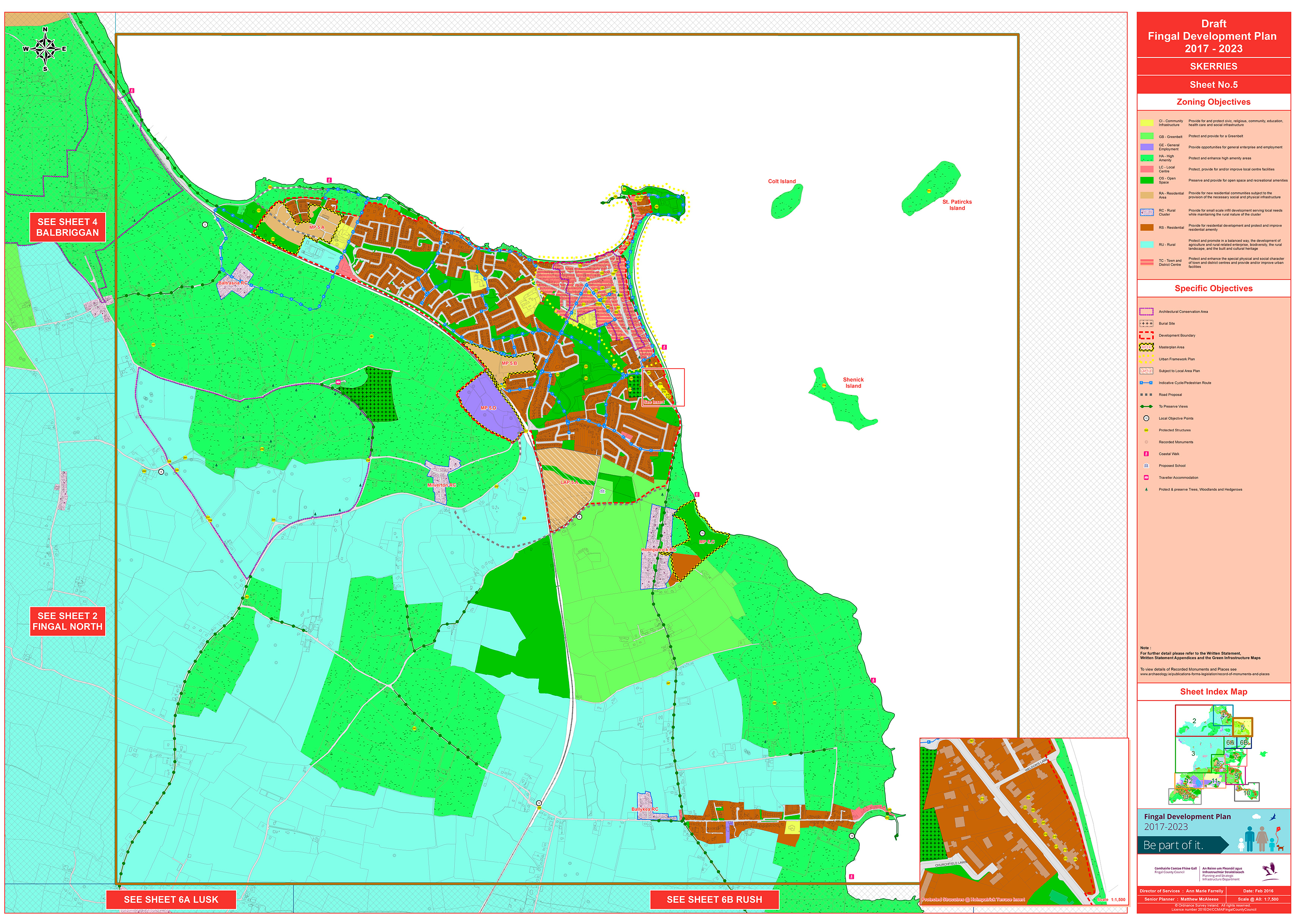
Map-based Objective 5 from Sheet 5 - Skerries - is:
Prepare a Recreational Strategy for Ardgillan Demesne with an emphasis on enhancing access
Chapter 3, Placemaking, of the...
Map 5: Skerries
Closed19 Feb, 2016, 10:00 - 29 Apr, 2016, 17:30
Click on map to view high resolution version.
Contents
Materials
References
Observations
Observations
Indicative Cycle/Pedestrian Routes
The Skerries map in the draft Development Plan has many blue lines for 'Indicative Cycle/Pedestrian Route' some of which do not correspond with local geography.
For example, an...
Distributor Road
Map 5 - Skerries - shows the gray dotted line for 'Road Proposal' for the extension of the distributor road to join the Balbriggan road and a gray dotted line for the section of the Balbriggan road...
Typographical Error
The map misspells ‘St Patricks Island’ as ‘St Patircks Island’. This should be corrected.
Proposed LAP for Loughshinny
Proposed LAP for Loughshinny within the lifspan of the new Development Plan