See Submission Attached
Chapter 9: Green Infrastructure and Natural Heritage
Dúnta24 Fea, 2022, 09:00 - 12 Bea, 2022, 23:59
9.1 Introduction
Green Infrastructure can be understood as a planned network of interconnected natural areas such as parks, rivers and open spaces that help to conserve natural ecosystem functions. Green Infrastructure planning results in environmental, economic and social benefits by providing nature- based solutions to development objectives. This approach results in resilient urban landscapes adapted for and reducing the negative effects of climate change.
Fingal has a rich biodiversity resource with its coast, countryside, and urban centres. The value of biodiversity extends from the health and well-being benefits to be gained from contact with nature, to the economic gains for local businesses associated with food production and outdoor pursuits. Fingal contains a wealth of natural heritage, but the patterns of loss of this heritage mirrors the global pattern of biodiversity loss as our local habitats are lost and species numbers have declined. The challenge is to develop the County in a way which maintains and enhances biodiversity for future generations. Fingal’s response to habitat loss and species decline is the development of an Ecological Network that spans the entire County. The Ecological Network is made up of core nature conservation areas, buffer zones, and nature development areas and ecological corridors.
9.2 Context
Fingal County Council has developed the Ecological Network through forward planning initiatives and development management and is also involved in practical conservation projects together with local landowners and on Council owned lands. In Portrane, the Council is leasing a private site to preserve dune grassland and various rare plant species by means of a grazing regime with Highland cattle. Similarly, the Council is working with landowners on Howth to restore the heathland by means of grazing, invasive species control, wildfire management and wetland restoration. In response to objectives for new parks, open spaces and recreational facilities the Council is preparing development and management plans for Bremore Regional Park in Balbriggan, Ward River Valley Regional Park in Swords, Racecourse Park between Baldoyle and Portmarnock, Rogerstown Park located on the former Balleally Landfill near Rush and the Tolka Valley Regional Park in Dublin 15. All these new Regional Parks incorporate resilient design and include significant areas dedicated to nature conservation. Community Garden Initiatives provide existing and new local groups with opportunities to manage outdoor spaces close to their homes and the Council also provides in excess of 800 public allotment places (the highest per capita provision in the country).
9.3 Opportunities
Green Infrastructure and our natural heritage perform key functions for our communities. For example, our parks and open space promote health and well-being and make Fingal a better place to live in. Green Infrastructure also enhances opportunities for recreation and tourism, sustains our food industry and encourages new businesses to invest in the County. By providing a network of multifunctional green and blue spaces and protecting the natural environment there are opportunities to contribute to urban sustainability, climate resilience while increasing access to nature and providing a good quality of life for people. It is also recognised that Green Infrastructure is a vital component in building resilient communities capable of adapting to the consequences of climate change. To ensure the benefits of ecosystem services are realised in existing and new developments, various Green Infrastructure components can be incorporated in the design and management such as green roofs, green walls, trees, sustainable drainage systems (SuDS); bird and bat boxes in walls and wildflower meadows. Green roofs and walls can help to regulate the structures internal temperature and reduce storm water run- off. The SUDS wetlands help improve water quality and prevent flash flooding. The tree canopy helps regulate urban heat and improves air quality and provides shade. Birds and bats help to regulate insects and open space and gardens can provide corridors for the movement of wildlife.
9.4 Strategic Aims
Green Infrastructure and Natural Heritage are embedded in planning policy at national and regional levels through the NPF and the RSES. Key policy objectives centre on integrated planning for Green Infrastructure and Ecosystem Services (NPO 58; NPO 62; RSO 10; RPO 7.12) and enhanced Green Infrastructure is a key strategic outcome. The NPF also states that: Green Infrastructure planning will inform the preparation of regional and metropolitan strategies and city and county development plans by: Assisting in accommodating growth and expansion, while retaining the intrinsic value of natural places and natural assets; Providing increased certainty in planning by proactively addressing relevant environmental issues; Encouraging more collaborative approaches to plan-making by enabling examination of the interactions between future development requirements and the capacity of receiving areas; and ensuring that sufficient and well-planned green spaces, commensurate in scale to long-term development requirements, are designated in statutory plans.
The NPF also stresses that "It is also important to consider the interrelationships between biodiversity, natural heritage, landscape and our green spaces."
NPO 60 requires that policy ‘Conserve and enhance the rich qualities of natural and cultural heritage of Ireland in manner appropriate to their significance’
Likewise, the RSES also provides key Regional Policy Objectives.
RPO 7.16 Support the implementation of the Habitats Directive in achieving an improvement in the conservation status of protected species and habitats in the region and ensure alignment between the core objectives of the EU birds and Habitats Directives and local authority development plans.
RPO 7.17 Facilitate cross boundary co-ordination between Local Authorities and the relevant agencies in the Region to provide clear governance arrangements and co-ordination mechanisms to support the development of ecological networks and enhanced connectivity between protected sites while also addressing the need for management of alien invasive species and the conservation of native species.
The European Union Biodiversity Strategy 2030 contains specific commitments to protect 30% of EU land and sea territory sets out actions to achieve this, including building upon existing Natura 2000 areas; addressing the key drivers of biodiversity loss with a European Union Nature Restoration Plan and measures to tackle the global biodiversity challenge. To bring nature back to cities, the Commission calls on European cities of at least 20,000 inhabitants to develop ambitious Urban Greening Plans. These should include measures to create biodiverse and accessible urban forests, parks and gardens; urban farms; green roofs and walls; tree-lined streets; meadows and hedges. They should also help improve connections between green spaces, eliminate the use of pesticides, limit excessive mowing of urban green spaces and other biodiversity harmful practices. The promotion of healthy ecosystems, Green Infrastructure and nature-based solutions should be systematically integrated into urban planning, including in public spaces, infrastructure, and the design of buildings and their surroundings.
In 2019 Dáil Éireann declared a national biodiversity crisis. The National Biodiversity Action Plan 2017- 2021 contains a number of relevant objectives and actions aimed at mainstreaming biodiversity into decision making while the Regional Spatial and Economic Strategy supports the implementation of the EU Birds and Habitats Directives and aims to ensure alignment between its core objectives and local authority development plans (RPO 7. 16). Biodiversity protection is also incorporated into the Marine Strategy Framework Directive, the Water Framework Directive (marine waters) the Nitrates Directive (agricultural run-off), the SEA Directive, EIA Directive and the Invasive Species Regulations.
9.5 Policies and Objectives
|
Policy GINHP1 Resilient Design Promote an awareness of the benefits of Resilient Design and the multi-functional nature of Green Infrastructure. Apply principles of Green Infrastructure to inform the development management process in terms of design and layout of new residential areas, business/industrial development and other significant projects while maximizing the multi-functional nature of Green Infrastructure by ensuring the development of synergies between Public Open Space, Biodiversity, SuDS/Water Sensitive Design and Active Travel objectives. |
|
Policy GINHP2 Protection of Green Infrastructure Ensure that areas and networks of Green Infrastructure are identified, protected, enhanced, managed and created to provide a wide range of environmental, social and economic benefits to communities. |
|
Policy GINHP3 Greening of Developments Encourage measures for the ‘greening’ of new developments including the use of green roofs, brown roofs, green walls and water harvesting. |
|
Objective GINHO1 Urban Greening Plans Develop Urban Greening Plans for Balbriggan, Swords and the wider Dublin 15 area. |
9.5.1 Green Infrastructure Themes
The Council has identified a number of key Green Infrastructure (GI) themes. These are:
- Biodiversity,
- Parks, Open Space and Recreation,
- Sustainable Water Management,
- Archaeological and Heritage Landscapes
- Landscape.
|
Policy GINHP4 Green Infrastructure Themes Ensure the Green Infrastructure strategy for Fingal protects existing Green Infrastructure resources and plans for future Green Infrastructure provision which addresses the five main themes identified in this Plan, namely: Biodiversity, Parks, Open Space and Recreation, Sustainable Water Management, Archaeological and Heritage landscapes, Landscape. |
9.5.1.1 Biodiversity
Biodiversity can be defined as the diversity of plants, animals, insects, birds, fish and micro-organisms and their habitats in which they live and interact, such as grasslands, woodlands, streams, hedgerows, public parks and private gardens. The County’s natural heritage is a core component of Fingal’s Green Infrastructure. Key elements are
- Fingal’s Ecological Network includes Core Biodiversity Conservation Areas: Ramsar sites, Natura 2000 sites (Special Areas of Conservation (SAC) and Special Protection Areas (SPAs)), Natural Heritage Areas (NHA), proposed Natural Heritage Areas (pNHA), Statutory Nature Reserves, Refuges for Fauna, Annex I habitats outside designated sites, habitats of protected or rare flora
- Ecological Buffer Zones
- Nature Development Areas
- River Corridors along major Rivers.
|
Policy GINHP5 Green Infrastructure Network Develop the Green Infrastructure network to ensure the conservation and enhancement of biodiversity, including the protection of European Sites, the provision of accessible parks, open spaces and recreational facilities (including allotments and community gardens), the sustainable management of water, the maintenance of landscape character including historic landscape character and the protection and enhancement of archaeological and heritage landscapes. |
|
Objective GINHO2 Fragmentation Reduce fragmentation and enhance the resilience of Fingal’s GI network by strengthening ecological links between urban areas, Natura 2000 sites, proposed Natural Heritage Areas, parks and open spaces and the wider regional network by connecting all new developments into the wider Green Infrastructure network. |
|
Objective GINHO3 Biodiversity in Open Space Make provision for biodiversity within public open space and include water sensitive design and management measures (including SuDS) as part of a sustainable approach to open space design and management. |
|
Objective GINHO4 Green Infrastructure and Development Resist development that would fragment or prejudice the County's strategic Green Infrastructure network. |
|
Objective GINHO5 Pollinator Plan Continue to support the provisions of the National Pollinator Plan 2021-2025 through the management and monitoring of the County’s pollinator protection sites and through the promotion of additional pollinator sites during the lifetime of this Development Plan. |
|
Objective GINHO6 Agriculture and Horticulture Safeguard important agricultural and horticultural lands in the County. |
9.5.1.2 Parks, Open Space and Recreation
This theme is defined as lands zoned open space and/or in use as public open space. The Council has established 2,000 hectares of public open space that are increasingly managed in a sustainable manner to ensure that future generations can enjoy the benefits of these amenities for recreation, health and wellbeing.
|
Policy GINHP6 Multi-Functionality Ensure delivery of multifunctional green and civic spaces that meet community needs, promote active and passive recreation, flood and surface water management and local habitat improvements. The multi-functionality of spaces will be balanced against the need to protect and enhance local habitat and the recreational and functional requirements of parks. |
|
Objective GINHO7 Provision of Open Space Provide a range of accessible new parks, open spaces and recreational facilities accommodating a wide variety of uses (both passive and active), use intensities and interests. |
|
Objective GINHO8 Routes Provide attractive and safe routes linking parks and open spaces and other related features such as cultural sites and heritage assets as an integral part of Green Infrastructure provision, where appropriate and feasible. |
|
Objective GINHO9 Greenways and Net Gain Ensure that all greenway developments have a biodiversity net gain. Nature conservation and opportunities for biodiversity enhancement will be a key part of these infrastructure projects and nature conservation will be considered throughout the lifetime of the project and into the future, following project completion. |
|
Objective GINHO10 Food Production Provide opportunities for Fingal residents to engage in food production through allotments, community gardens and the provision of food foraging areas in new parks and Green Infrastructure proposals where appropriate. |
|
Objective GINHO11 Donabate Turvey Nature Reserve That Fingal County Council in the lifetime of this development plan provides for the development of a wildlife, education and rehabilitation centre within the Turvey Nature Reserve, Turvey Donabate. |
9.5.1.3 Sustainable Water Management
The considered management and enhancement of watercourses including rivers and streams; riverine floodplains and wetland areas and coastal areas liable to flooding can provide effective measures to help manage flooding and improve the quality of water.
|
Policy GINHP7 Protection Protect and enhance the natural, historical, amenity and biodiversity value of the County’s watercourses, flood plains, riparian corridors, wetlands and coastal area though long-term and liaison with relevant Prescribed Bodies where appropriate. |
|
Objective GINHO12 Requirements Ensure the provision of new Green Infrastructure addresses the requirements of functional flood storage, the sustainable management of coastal erosion, and links with provision for biodiversity, Sustainable Drainage Systems (SuDS) and provision for parks and open space wherever possible and appropriate. |
|
Objective GINHO13 Wetlands Seek the creation of new wetlands and/or enhancement of existing wetlands through provision for Sustainable Drainage Systems (SuDS) where appropriate. |
|
Objective GINHO14 Green Roofs Seek the provision of green roofs and green walls as an integrated part of Sustainable Drainage Systems (SuDS) and which provide benefits for biodiversity, wherever possible. |
|
Objective GINHO15 SuDs Limit surface water run-off from new developments through the use of appropriate Sustainable Urban Drainage Systems (SuDS) using nature-based solutions and ensure that SuDS is integrated into all new development in the County. |
|
Objective GINHO16 Coastal Ensure the Green Infrastructure strategy for Fingal protects the County’s natural coastal defences, such as beaches, sand dunes, salt marshes and estuary lands, and promotes the use of soft engineering techniques as an alternative to hard coastal defence works wherever possible. |
9.5.1.4 Archaeological and Heritage Landscapes
There is a significant link between our archaeological, built and natural heritage. Historic graveyards, stone structures and ruins are a rich part of not only our cultural but natural heritage and are of significant ecological value while archaeological monuments are often preserved within open space.
|
Policy GINHP8 Archaeology and Green Infrastructure Protect, conserve and enhance landscape, natural, cultural and built heritage features, and support the implementation of the Fingal Heritage Plan in relation to the provision of Green Infrastructure. |
|
Objective GINHO17 Fingal Heritage Plan Protect, conserve and enhance landscape, natural, cultural and built heritage features, and support the objectives and actions of the Fingal Heritage Plan. |
|
Objective GINHO18 Heritage Landscape Ensure, wherever possible and appropriate, that elements of the archaeological and heritage landscape are fully integrated into proposals for new developments at the project design stage. |
9.5.1.5 Landscape
This theme includes the Special Amenity Areas on Howth Head and the Liffey Valley; High Amenity Areas; Highly Sensitive Landscapes; and County Geological Sites.
|
Policy GINHP9 Landscape Character Ensure Green Infrastructure provision responds to and reflects landscape character including historic landscape character, conserving, enhancing and augmenting the existing landscapes and townscapes of Fingal which contribute to a distinctive sense of place. |
9.5.2 Green Infrastructure and Planning
A key objective of Green Infrastructure planning is that Green Infrastructure management and provision is integrated with plans for growth and development. All proposals for development must take account of the County’s strategic Green Infrastructure resources and ensure that these are protected, managed and enhanced as new development takes place. In addition, proposals for development must seek to provide for the protection and provision of Green Infrastructure which addresses the five GI themes identified in the Development Plan in a coherent and integrated manner.
Rewilding is defined as the process of innovation in conservation philosophy science and management, characterized by a desire to restore ecological processes at various scales, often through the introduction of functional species and restoration of natural processes.
|
Policy GINHP10 Green Infrastructure and Development Seek a net gain in Green Infrastructure through the protection and enhancement of existing assets, through the provision of new Green Infrastructure as an integral part of the planning process, and by taking forward priority projects including those indicated on the Development Plan Green Infrastructure maps during the lifetime of the Development Plan. |
|
Objective GINHO19 Green Networks Create an integrated and coherent Green Infrastructure for the County by requiring the retention of substantial networks of green space in urban, urban fringe and adjacent countryside areas to serve the needs of communities now and in the future including the need to adapt to and mitigate climate change. |
|
Objective GINHO20 Green Infrastructure and Recreation Where new residential development is proposed, seek, where appropriate to maximise the use and potential of existing parks, open spaces and recreational provision, by upgrading and improving the play and recreational capacity of these existing facilities through development contributions in lieu of new open space or play provision. |
|
Objective GINHO21 Integration of Green Infrastructure |
|
Avoid the fragmentation of green spaces in site design and to link green spaces /greening elements to existing adjacent Green Infrastructure / the public realm where feasible and to provide for ecological functions. |
|
Objective GINHO22 Network Fragmentation Resist development that would fragment or prejudice the County’s strategic Green Infrastructure network. |
|
Objective GINHO23 Policies Support The Forest of Fingal-A Tree Strategy for Fingal, Keeping it Green – An Open Space Strategy for Fingal and Space for Play- A Play Policy for Fingal in this Plan. |
|
Objective GINHO24 Allotment Strategy Continue to support Fingal’s Allotment Strategy, Community Gardens initiatives within the County |
|
Objective GINHO25 Reintroduction Promote reintroduction programmes. Reintroduction programmes are an important part of rewilding and increasing biodiversity in the County. |
|
Objective GINHO26 Rewilding Continue to promote and support re-wilding and pollinator initiatives within the County. |
9.6 Natural Heritage
Our natural heritage includes the variety of life we see around us every day, often referred to as biodiversity. Biodiversity includes everything from trees to weeds, from mammals to birds, from coast to countryside. Fingal hosts a wealth of wildlife including many threatened habitats and plant and animal species which are protected by law. The Baldoyle, Malahide and Rogerstown Estuaries support thousands of migratory birds during the winter. These sites have been designated as Special Areas of Conservation (SACs) or Special Protection Areas (SPAs) under the EU Habitats and Birds Directives. At EU level the most important habitats and species are protected through Natura 2000 which is the network of protected areas established under the Habitats and Birds Directives. In addition, member states are called on to develop and implement wider countryside measures in their land-use planning and development policies that support the coherence of the Natura 2000 network pursuant to Article 10 of the Habitats Directive and Article 3 of the Birds Directive.
At national level biodiversity policy is set out in the National Biodiversity Plan (NBP) which identifies habitat degradation and loss as the main factor eroding biodiversity in Ireland today. The spread of invasive species is also a growing problem and prohibitions are in place in relation to the introduction or dispersal of certain invasive species as set out in the Third Schedule of the European Communities (Birds and Habitats Regulations 2011 (S.I. 477/2011). Many of the policy provisions of the NBP are given effect through the legislative framework provided by the Wildlife Acts (1976 - 2012) and through the implementation of the Habitats Directive, the Birds Directive and the Water Framework Directive. Among other things, the NBP calls on local authorities to move towards no net loss of biodiversity through development management, to include policies and objectives in their County Development Plans for the protection and restoration of biodiversity and to develop a Green Infrastructure network at local level and promote the use of nature-based solutions for the delivery of a coherent and integrated network. It is important that all development proposals include measures to protect and enhance biodiversity. This will be achieved through the Development Management process and reference should be made to the Development Management Standards set out in Chapter 14.
|
Policy GINHP11 Biodiversity Action Plan Support the adoption and implementation of the Fingal Biodiversity Action Plan, implementation of the National Biodiversity Action Plan (2017- 2021) and the All-Ireland Pollinator Plan (2021-2025) and any superseding plans. |
|
Policy GINHP12 Protected Sites Protect areas designated or proposed to be designated as Natura 2000 sites (i.e. Special Areas of Conservation (SACs) and Special Protection Areas (SPAs), proposed Natural Heritage Areas (pNHAs), Natural Heritage Areas (NHAs), Statutory Nature Reserves, and Refuges for Fauna. |
|
Policy GINHP13 Fingal Ecological Network Support the development of the Fingal Ecological Network in line with the Fingal Biodiversity Action Plan. |
|
Policy GINHP14 Biodiversity Net Gain Guidance Promote biodiversity net gain in new developments and develop a planning guidance document on Biodiversity Net Gain. |
|
Policy GINHP15 Biodiversity in Buildings Guidance Promote the inclusion of swift, swallow, house martin, house sparrow, starling, bat and insect boxes and structure in and on building facades and develop a guidance document on how to incorporate these structures into buildings. |
|
Policy GINHP16 Rewilding and Pollinator Initiatives Promote and support rewilding and pollinator initiatives in Fingal. |
|
Objective GINHO27 National Parks and Wildlife Service Support the National Parks and Wildlife Service, in the maintenance and achievement of favourable conservation status for the habitats and species in Fingal by taking full account of the requirements of the Habitats and Birds Directives, in the performance of its functions. |
|
Objective GINHO28 Protection of Natural Heritage Areas Ensure that development does not have a significant adverse impact on proposed Natural Heritage Areas (pNHAs), Natural Heritage Areas (NHAs), Statutory Nature Reserves, Refuges for Fauna, Habitat Directive Annex I sites and Annex II species contained therein, and on rare and threatened species including those protected by law and their habitats. |
|
Objective GINHO29 Biodiversity and Open Space Ensure that the management of the Council’s open spaces and parks is pollinator-friendly, provides more opportunities for biodiversity, and is carried out without the use of pesticides where possible. |
|
Objective GINHO30 Infrastructure and Net Biodiversity Gain All greenway and infrastructure projects are to have a net biodiversity gain and this principle shall be incorporated from the start of the project. |
|
Objective GINHO31 Invasive Species Continue the control programs of invasive species with all relevant stakeholders and landowners to control the key invasive species. |
|
Objective GINHO32 Development and Invasive Species Ensure that proposals for development do not lead to the spread or introduction of invasive species. If developments are proposed on sites where invasive species are or were previously present, the applications will be required to submit a control and management program for the particular invasive species as part of the planning process and to comply with the provisions of European Communities (Birds and Natural Habitats) Regulations 2011 and EU Regulations 1143/2014. |
9.6.1 Biodiversity Conservation in Fingal
Fingal hosts a wealth of wildlife including a range of threatened habitats and species which are protected by law. The most important sites for wildlife can be found along the coast. Baldoyle, Malahide and Rogerstown estuaries and the islands off the Fingal coast host a range of important habitats and species as well as being home to thousands of breeding and migratory birds. The Rockabill to Dalkey Island marine Special Area Conservation (SAC) is located off the Fingal coast and was designated for the underwater reefs and as a habitat for Harbour Porpoise. In addition to the coastal sites, two wetland sites in Fingal (Sluice River Marsh and the Bog of the Ring) are proposed for designation as Natural Heritage Areas (NHA) under national wildlife legislation.
The occurrence of protected flora and fauna species is not confined to protected sites. Protected birds, bats, otters and badgers for example are frequently found in the wider countryside. The Fingal Ecological Network sets out a spatial framework for biodiversity conservation and management in Fingal. The ecological network consists of the following elements (See Green Infrastructure Maps):
- Core Biodiversity Conservation Areas,
- Ecological Buffer Zones around Core areas,
- Nature Development Areas,
- Ecological Corridors and Stepping Stones including Trees and Hedgerows.
The approach is primarily based on strictly protecting the most important biodiversity conservation areas in the County as required by law, including the identification and protection of ecological buffer zones around these areas, providing opportunities for nature through the development of conservation initiatives in nature development areas and by protecting important movement corridors and stepping stones for wildlife in the landscape.
9.6.2 Core Biodiversity Conservation Areas
The most important nature conservation sites make up the core biodiversity conservation areas. These include internationally and nationally designated sites, sites hosting habitats listed in Annex I of the Habitats Directive and sites hosting rare and protected flora species and their habitats. Special Areas of Conservation (SACs) and Special Protection Areas (SPAs) are being or have been, designated to conserve habitats and species of European importance pursuant to the EU Habitats and Birds Directives. These sites are part of a pan-European network known as Natura 2000 (See Table BD01). Article 6 of the Habitats Directive requires that the impacts of any plans or projects likely to affect Natura 2000 sites are assessed by the Planning Authority via Appropriate assessment (see Chapter 14 – Development Management Standards).
|
Policy GINHP17 Protection of European and National Sites Strictly protect areas designated or proposed to be designated as Natura 2000 sites (i.e. Special Areas of Conservation (SACs) and Special Protection Areas (SPAs); also known as European sites) including any areas that may be proposed for designation or designated during the lifetime of this Plan. |
Table 9.1 Protected Areas of International and National Importance
|
Location |
SAC |
SPA |
pNH A |
NHA |
WFDR PA |
Rams ar |
SNR |
RF F |
|
Baldoyle Bay |
✓ |
✓ |
✓ |
|
✓ |
✓ |
✓ |
|
|
North Bull Island |
|
✓ |
|
|
✓ |
✓ |
✓ |
|
|
Bog of the Ring |
|
|
✓ |
|
✓ |
|
|
|
|
Zone* Marine SAC |
✓ |
|
|
|
|
|
|
|
|
Feltrim Hill |
|
|
✓ |
|
✓ |
|
|
|
|
Howth Head |
✓ |
✓ |
✓ |
|
✓ |
|
|
|
|
Ireland's Eye |
✓ |
✓ |
✓ |
|
✓ |
|
|
|
|
Lambay Island |
✓ |
✓ |
✓ |
|
✓ |
|
|
|
|
Knock Lake |
|
|
✓ |
|
✓ |
|
|
|
|
Liffey Valley |
|
|
✓ |
|
✓ |
|
|
|
|
Loughshinny Coast |
|
|
✓ |
|
✓ |
|
|
|
|
Malahide/Swords/Broad meadow Estuary |
✓ |
✓ |
✓ |
|
✓ |
✓ |
|
|
|
North Dublin Bay |
✓ |
|
✓ |
|
✓ |
|
|
|
|
Portraine Shore |
|
|
✓ |
|
✓ |
|
|
|
|
Rockabill Island |
|
✓ |
✓ |
|
✓ |
|
|
✓ |
|
Rockabill to Dalkey |
✓ |
|
|
|
|
|
|
|
|
Rogerstown |
✓ |
✓ |
✓ |
|
✓ |
✓ |
✓ |
|
|
Royal Canal |
|
|
✓ |
|
✓ |
|
|
|
|
Santry Demesne |
|
|
✓ |
|
✓ |
|
|
|
|
Skerries Islands |
|
✓ |
|
✓ |
✓ |
|
|
|
|
Sluice River Mars |
|
|
✓ |
|
✓ |
|
|
|
SAC = Special Area of Conservation SPA = Special Protection Area
pNHA = proposed Natural Heritage Area NHA = Natural Heritage Area
WFDRPA = Water Framework Directive Register of Protected Areas site Ramsar = site designated pursuant to Ramsar Convention on Wetlands SNR = Statutory Nature Reserve
RFF = Refuge for Fauna
* = This area is not mapped on Green Infrastructure 2, Sheet 15 owing to the 24 km distance from shore but can be reviewed in SI 99 of 2016, 24 February 2016, as a map is attached. See www.npws.ie.
9.6.3 Protected Areas of National Importance
Under the Wildlife (Amendment) Act, 2000 Natural Heritage Areas (NHAs) are being designated to conserve species and habitats of national importance. This includes the Liffey Valley, Royal Canal and wetland sites such as the Sluice River Marsh and the Bog of the Ring. There are also a number of Statutory Nature Reserves and Refuges for Fauna in Fingal. These areas, established under the Wildlife Acts 1976 to 2012, are areas where nature conservation is the primary objective and takes precedence over all other activities. The Council will normally only grant permission where it is clearly demonstrated that a proposal will have no significant adverse impact on the habitats and species of interest in the designated area and its ecological integrity.
9.6.4 Habitat Areas Listed on Annex I of the Habitats Directive Located Outside Designated Areas
A number of areas hosting habitats listed in Annex I of the Habitats Directive but outside Special Areas of Conservation (SACs) have been identified in the County (see Green Infrastructure Maps). These include sand-dunes, shingle and gravel banks and shores, orchid rich grasslands, petrifying springs, and vegetated sea cliffs. The majority of these habitats are found along the coast. Some of these habitats are also important for coastal defence. The Council will normally only grant planning permission where it is clearly demonstrated that a proposal will have no significant adverse impact on the habitats of interest in these areas and their ecological integrity.
9.6.5 Rare and Protected Species and their Habitats
See also Green Infrastructure Maps and Fingal Biodiversity Action Plan
Certain plant, animal and bird species are rare and threatened. This includes nationally rare plants which occur in Fingal, plants listed in the Red Data Lists of Irish Plants, Flora (Protection) Order 2015 (or other such Orders) and their habitats, birds listed in Annex I of the Birds Directive, and animals and birds listed in the Wildlife Acts 1976 to 2012 and subsequent statutory instruments. Many of these species are protected by law. In addition, strict protection under the Habitats Directive applies to the species listed in Annex IV of that Directive, including all bat species, the otter, and all cetaceans. Where Annex IV species are present, all possible measures to avoid damage and disturbance to them must be taken in the formulation of proposals for development. Where the risk of damage or disturbance is unavoidable, an application for a derogation licence may be made to the Minister for the Department of Housing, Local Government and Heritage under Regulation 54 or 55 of the European Communities (Birds and Natural Habitats) Regulations 2011 (S.I. 477/2011). The derogation licence should be obtained in advance of seeking planning permission for a proposed development. An Ecological Impact Assessment shall be required for any proposed development likely to have a significant impact on species protected by law and their habitats. The Council will normally only grant permission where it is clearly demonstrated that a proposal will have no significant adverse impact, is incapable of satisfactory avoidance or mitigation on the species of interest and associated habitat(s).
|
Policy GINHP18 Species Protection The Council will seek to protect rare and threatened species, including species protected by law and their habitats by requiring planning applicants to demonstrate that proposals will not have a significant adverse impact on such species and their habitats. |
|
Objective GINHO33 Annex I and Annex II Ensure that development does not have a significant adverse impact on proposed Natural Heritage Areas (pNHAs), Natural Heritage Areas (NHAs), Statutory Nature Reserves, Refuges for Fauna, Habitat Directive Annex I sites and Annex II species contained therein, and on rare and threatened species including those protected by law and their habitats. |
9.6.6 Ecological Buffer Zones
The Council has identified lands around Malahide/Broadmeadow, Rogerstown and Baldoyle estuaries and around Sluice River Marsh and the Bog of the Ring as ecological buffer zones. These buffer zones protect the ecological integrity of the nationally and internationally designated sites by providing suitable habitat for key species such as birds, by providing for compatible landuses around the designated sites, and in the case of the freshwater wetland areas, by ensuring a steady supply of clean groundwater and surface water. Around the estuaries the buffer zones can also provide for recreational uses and are also important for coastal flood protection and for climate change adaptation. Ecological buffer zones are areas where agricultural uses may be combined with nature conservation and low-intensity recreational use such as walking and cycling.
|
Policy GINHP19 Ecological Buffer Zones Protect the functions of the ecological buffer zones and ensure proposals for development have no significant adverse impact on the habitats and species of interest located therein. |
|
Objective GINHO34 Ecological Management Plans Develop Ecological Management Plans for the Rogerstown, Malahide and Baldoyle Estuaries focusing on their ecological protection and that of their surrounding buffer zones. |
|
Objective GINHO35 Appropriate Assessment In accordance with Appropriate Assessment of Plans and Projects in Ireland, Guidance for Planning Authorities (2010), any plans or projects that are likely to have a significant effect on a Natura 2000 site, either individually or in combination with other plans or projects, are subject to a screening for Appropriate Assessment unless they are directly connected with or necessary to the management of a Natura 2000 site. |
|
Objective GINHO36 Biodiversity Gain in Farmland Promote biodiversity gain by allocating a proportion of Council owned land currently leased for farming for the purposes of rewilding and biodiversity initiatives over the lifetime of this plan. |
9.6.7 Nature Development Areas
'Nature Development Areas', are locations where nature conservation can be combined with existing activities such as farming, forestry, quarrying and recreation (e.g. golf courses). These areas are reservoirs of biodiversity in the wider countryside and together with the corridors and stepping stones allow species to move through the landscape. Specific objectives have been developed for the Nature Development Areas in the Fingal Biodiversity Action Plan and the Council will work with landowners to achieve benefits for biodiversity in these areas.
|
Objective GINHO37 Nature Development Areas Maintain and/or enhance the biodiversity of the Nature Development Areas indicated on the Green Infrastructure maps. |
|
Objective GINHO38 Demonstration Sites Develop a demonstration site for each Nature Development Area. |
9.6.8 Ecological Corridors and Stepping Stones Including Trees and Hedgerows
Ecological corridors are linear landscape features such as rivers, hedgerows and road verges that facilitate the movement of wildlife through the landscape. Stepping stones are located along these corridors and comprise a series of smaller landscape features such as small woodlands, areas of scrub, wet grassland and marshes. The key corridors in Fingal are along the major rivers, including their floodplains and the adjacent farmland or parkland. The Liffey, Tolka, Pinkeen, Ward, Broadmeadow, Ballyboghil, Corduff, Sluice, Mayne and Delvin rivers and their tributaries, are salmonid systems (designated pursuant to Directive 78/659/EEC) and are therefore of particular significance. The Liffey and the Ward river are exceptional in supporting Atlantic Salmon (listed in Annex II of the Habitats Directive), Sea Trout and Brown Trout populations. To be ecologically effective corridors need to be a minimum of 30m in width measured from the top of each riverbank. This width allows many species associated with rivers such as the Otter, Bats, Kingfisher, and Dipper, together with the aquatic species in the rivers such as Salmon, Sea Trout, Brown Trout and Lamprey to thrive. These have been selected because of their existing or potential value for wildlife. A buffer of a minimum width of 10m measured from each bank shall apply along small streams and drains. A minimum 10m wide riparian buffer strip measured from the top of the bank either side of all watercourses applies to lands within urban areas - i.e. within designated settlement boundaries (as per FCC’s Settlement Hierarchy set out in Chapter 2, Planning for Growth). Where lands encompass urban and rural areas, a transitional approach from the urban riparian requirements to the rural riparian requirements may be appropriate and will be assessed on a case-by-case basis.
Within urban areas the Council aims to protect, develop and enhance terrestrial urban ecological corridors along existing linear features such as hedgerows where possible with a minimum width of 25m. These corridors comprise of a mixture of hedgerow, scrub, rank grassland, wildflower meadow, ponds, marshland and dead timber. SuDS features such as ponds and wetlands can be incorporated within these corridors. Green corridors should be incorporated into all new large developments, as part of Green Infrastructure provision, linking large areas of open space and linking with areas outside the development site.
The Council will normally only grant planning permission where it is clearly demonstrated that a proposal will not adversely affect the habitats and/or species of interest in the corridor or stepping stone or compromise its function as an ecological corridor or stepping stone. Proposals for development affecting these areas should also seek to enhance the ecological values of the corridor or stepping stone as an integral part of the proposal. An ecological assessment may be required for any proposed development likely to have a significant impact on habitats and species of interest in an ecological corridor or stepping stone.
|
Policy GINHP20 Mammal Ledges Protect the ecological corridor function along rivers by including mammal ledges or tunnels in new bridges over any of the main rivers: Liffey, Tolka, Pinkeen, Mayne, Sluice, Ward, Broadmeadow, Ballyboghil, Corduff, Matt and Delvin. New bridge structures will also cater for Dipper boxes and Bats where possible. Where new road infrastructure crosses significant urban ecological corridors, tunnels shall be installed underneath the road to facilitate movement of small mammals and amphibians. |
|
Objective GINHO39 Ecological Corridor Guidance Develop Design Guidance document for ecological corridors |
|
Objective GINHO40 Ecological Assessments Protect the ecological functions and integrity of the corridors indicated on the Plan Green Infrastructure maps. An ecological assessment may be required for any proposed development likely to have a significant impact on habitats and species of interest in an ecological corridor or stepping stone. |
|
Objective GINHO41 Protection of Rivers Protect rivers, streams and other watercourses and maintain them in an open state capable of providing suitable habitat for fauna and flora, including fish. |
|
Objective GINHO42 Inland Fisheries Take full account of Inland Fisheries Guidelines on the Protection of Fisheries during Construction works in and adjacent to Waters (2016) and Planning for Water Courses in the Urban environment (2020) when undertaking, approving or authorising development or works which may impact on rivers, streams and canals and their associated habitats and species. |
9.6.9 Protection of Trees and Hedgerows
There is extensive evidence for the wide range of services and value of trees and hedgerows including establishing a sense of place and providing healthy environments. Trees also contribute to visual amenity in built-up areas and by adding significant visual interest in more rural areas. Hedgerows often mark historic field patterns and townland boundaries and significantly enhance the landscape character of rural areas. Trees and hedgerows also perform a vital role as wildlife habitats, biodiversity corridors and essential green elements in the County’s Green Infrastructure network. They have a further crucial role in improving urban air quality and carbon sequestration (capturing and storing carbon), contributing to the mitigation of climate change.
|
Policy GINHP21 Protection of Trees and Hedgerows Protect existing woodlands, trees and hedgerows which are of amenity or biodiversity value and/or contribute to landscape character and ensure that proper provision is made for their protection and management. |
|
Policy GINHP22 Tree Planting Provide for appropriate protection of trees and hedgerows, recognising their value to our natural heritage, biodiversity and climate action and encourage tree planting in appropriate locations. |
|
Objective GINHO43 Hedgerow Categorisation Develop a ‘Hedgerow Categorisation and Management Appraisal Tool’ and associated appropriate planning and management requirements for Development Management purposes to ensure a sustainable future for retained hedgerows in the context of new developments. |
|
Objective GINHO44 Tree Removal Ensure adequate justification for tree removal and require documentation and recording of reason where felling is proposed and avoid removal of trees without adequate justification. |
|
Objective GINHO45 Woodland Development Schemes Promote, encourage and support woodland development schemes by identifying suitable areas and support other initiatives that aim to establish and enhance woodlands for recreational purposes in partnership with local communities. |
9.6.10 Protected Trees (Tree Preservation Orders)
Tree Preservation Orders (TPOs) may be made under Section 205 of the Planning and Development Act 2000. A TPO can be made if it appears to the planning authority to be desirable and appropriate in the interest of amenity or the environment and can apply to a tree, trees, group of trees or woodland. Currently there are three locations where trees are covered by a Tree Preservation Order in Fingal. These are The Vicarage, Church Road, Swords, Santry Demesne and Brackenstown/Brazil, Swords.
|
Objective GINHO46 Tree Preservation Order Review Review Tree Preervation Orders within the County and maintain the conservation value of trees and groups of trees that are the subject of any Tree Preservation Order. |
|
Objective GINHO47 Tree Preservation Orders Consider the use of Tree Preservation Orders (TPOs) to protect important trees, groups of trees or woodlands. |
9.6.11 Shellfish Waters
See Green Infrastructure Maps
The aim of the Shellfish Waters Directive is to protect or improve shellfish waters by requiring Member States to designate waters that need protection in order to support shellfish life and growth. The Shellfish Waters Directive was transposed into legislation in Ireland by the European Communities (Quality of Shellfish Waters) Regulations 2006 (S.I. 268/2006), which were subsequently amended by the European Communities (Quality of Shellfish Waters) (Amendment) Regulations 2009 (S.I. 55/2009) and subsequently by the Amendment (No 2) Regulations 2009 (S.I. 464/2009). It is noted that at EU level the Shellfish Directive was repealed with shellfish waters being afforded protection under the WFD. There are two areas off the Fingal coast designated as Shellfish Waters pursuant to the Shellfish Regulations.
|
Objective GINHO48 Protection of Shellfish Waters Protect the quality of designated shellfish waters off the Fingal coast. |
9.6.12 County Geological Sites
The Geological Survey of Ireland (GSI) has identified 21 County Geological Sites in Fingal which are important geological heritage sites. Some of these sites may be designated, in due course, as National Heritage Areas (NHAs) because of their geological interest from a national perspective.
|
Policy GINHP23 Maintenance of Geological Sites Seek to maintain and where possible enhance the geological heritage of these sites and to provide access to these sites where possible and appropriate. |
|
Objective GINHO49 Protection of Geological Sites Protect and enhance the geological and geomorphological heritage of the County Geological Sites listed in Table 9.2. and indicated on Green Infrastructure Maps. |
|
Objective GINHO50 Access to Geological Sites Protect and promote safe and sustainable public access to County Geological Sites where appropriate and feasible subject to the requirements of Article 6 of the Habitats Directive. |
Table 9.2 Geological Heritage Sites
| Site Name | |||
| 1. |
Ardgillan House Boulder |
12. | Malahide Coast |
| 2. | Balrickard Quarry | 13. | Malahide Point |
| 3. | Balscadden Bay | 14. | Milverton Quarry |
| 4. | Bottle Quay | 15. | Mulhuddart (Lady's) Well |
| 5. | Claremont Strand | 16. | Nags Head Quarry |
| 6. | Curkeen Hill Quarry | 17. | Portraine Shore |
| 7. | Fancourt Shore | 18. | Rockabill |
| 8. | Feltrim Quarry | 19. | Shenick's Island |
| 9. | Hill of Howth | 20. | Skerries to Rush Coastline |
| 10. | Ireland's Eye | 21. | Walshestown Stream Section |
| 11. | Lambay Island | ||
Soils
Soil sealing can be defined as the destruction or covering of the ground by an impermeable material. It is one of the main causes of soil degradation and soil sealing often affects fertile agricultural land, puts biodiversity at risk, increases the risk of flooding and water scarcity and contributes to global warming. Urbanisation is an ongoing trend leading to land take and soil sealing at the expense of agricultural land and other open landscapes.
|
Objective GINHO51 Soils Reduce land take, soil sealing and loss of natural soils in urban and rural areas. |
9.6.13 Landscape
Landscapes are living elements that have responded to, and continue to respond to history, culture, natural cycles, weather events, water, climatic change and economic factors with influences spanning land uses such as agriculture, transport, tourism, industry and energy and settlement patterns. Landscapes give us a strong sense of place. The European Landscape Convention which Ireland ratified in 2002 forms the basis for inclusive and participative landscape management. It defines landscape as ‘…an area, as perceived by people, whose character is the result of the action and interaction of natural and/or human factors’ and this definition has been incorporated into the Planning and Development Act, 2000 (as amended).
The National Landscape Strategy for Ireland 2015-2025 recognises the importance of landscape protection and its relationship with biodiversity and climate change. The RSES recognises the need for national and regional landscape character assessments to be carried out to promote better landscape management and planning in the region, consistent with NPO 61 of the NPF and RPO 7.27 of the RSES.
|
Policy GINHP24 National Landscape Strategy Support the aims and objectives of the European Landscape Convention by implementing the relevant objectives and actions of the National Landscape Strategy 2015-2025. |
9.6.14 Landscape Character Assessment
The Development Plan’s Landscape Character Assessment (LCA) provides for the classification of Fingal’s landscapes into the following (1) types and values and (2) sensitivities. Character Types represent generic areas of distinctive character that makes one landscape different from another such as uplands or the coast, while Sensitivity is evaluated using criteria ranging from high to low. A highly sensitive landscape is likely to be vulnerable to change whereas a landscape with a low sensitivity is likely to be less at risk from change.
Table 9.3 Landscape Character Assessment Summary-Character, Value and Sensitivity
|
Landscape Character Types |
Landscape value |
Landscape Sensitivity |
|
Rolling Hills Type |
Modest |
Medium |
|
High Lying Type |
High |
High |
|
Low Lying Type |
Modest |
Low |
|
Estuary Type |
Exceptional |
High |
|
Coastal Type |
Exceptional |
High |
|
River Valley and Canal Type |
High |
High |
Rolling Hills Character Type
Rolling Hills Character Type is made up principally of agricultural land and is of value due to the Ward and Broadmeadow River and the ecological and visual attributes they bring. The protected views (R108 (St Margaret’s to Naul road) and R125 (Swords to Ashbourne Road), tree belts and undulating lands also add value to the area. An important quality is the archaeological heritage in Swords. The Rolling Hills Character Type is categorised as having a modest value.
High Lying Character Type
The High Lying Character Type is categorised as having a high value, its importance highlighted by the High Amenity zoning covering substantial parts of the area. This is an area of upland, rising to a high point of 176 metres at Hillfort Mound, to the southeast of the Naul. These hills afford panoramic views of the Mourne Mountains to the north, the coastline to the east and the Wicklow Mountains to the south. There are a number of important visual ridges on these uplands, that can be seen from wide areas of Fingal and Meath. Almost the whole County can be viewed from the more elevated roads. It
also has an important ecological value with strong hedgerows and the presence of the ‘Bog of the Ring’ proposed Natural Heritage Area here. There is little obtrusive or inappropriate development in the area and there is a pronounced absence of any substantial coniferous woodland.
Low Lying Character Type
Low Lying Character Type has an open character combined with large field patterns, few tree belts and low roadside hedges. The main settlements located within the area include Oldtown, Ballyboghil and Lusk and parts of Malahide and Donabate. Dublin Airport is located in this area. This low-lying area is dominated by agriculture and a number of settlements. The area is categorised as having a modest value. It contains pockets of important value areas requiring particular attention such as important archaeological monuments and demesnes and also the Feltrim Hill and Santry Demesne proposed Natural Heritage Areas
Estuary Character Type
The Estuary Character Type is categorised as having an exceptional value, recognised by the EU designations (candidate Special Areas of Conservation and Special Protection Areas) that apply to each in addition to national designations such as proposed Natural Heritage Areas and Ramsar. Estuary Character consists of the three large sand spits which have created protected estuarine and saltmarsh habitats of great ornithological and ecological interest at Rogerstown, Swords/ Malahide and Baldoyle. The flat horizontal nature of estuaries means that views are generally contained within the low hills and dunes that enclose these areas. There are some groups of trees to the edges of the estuary zones especially to the north side of the Swords/Malahide estuary. The character of these zones can alter depending on the tidal condition. The aesthetic quality of the estuaries is also outstanding.
Coastal Character Type
Coastal Character Type is categorised as having an exceptional landscape value. The type forms the eastern boundary of the County and contains a number of important beaches, islands and headlands that together create a landscape of high amenity and landscape value. A number of important settlements are located within this area, including Balbriggan, Skerries, Rush, Malahide, Portmarnock and Howth. The land is generally low lying, with the exception of some prominent headlands and hills in the northern part of the area, Howth and the offshore islands. Most of the Howth peninsula is covered by the 1999 Special Amenity Area Order (SAAO).
There are a number of important demesne or estate landscapes containing important woodlands in or adjoining this area at Ardgillan, Hampton, Milverton and Portrane. Horticulture (around Rush), golf courses and individual dwellings are prevalent land uses in the area also. Views along the coast are generally contained within headlands, ridgelines and harbours, creating a number of visual compartments.
The Coastal Character Type is categorised as having an exceptional landscape value. This value is arrived at due to the combination of visual, ecological, recreational and historical attributes. The area has magnificent views out to sea, to the islands and to the Mourne and Wicklow mountains and contains numerous beaches and harbours. The area’s importance is highlighted by the High Amenity zoning covering substantial parts of the area. The area is rich in archaeological, architectural and natural heritage and is of high ecological value.
River Valleys and Canal Character Type.
The Tolka and Liffey valleys together with the Royal Canal Corridor are the main landscape features in this area. The Tolka and Liffey valleys are characterised by areas of grassland along meandering river valleys which, especially in the case of the Liffey, are well wooded at the edge of the floodplain and along the valley slopes. Areas of both valleys support recreational facilities along their corridors. A number of institutional and private demesnes along the valley edges maintain a rural and wooded character to the areas. However, housing estates are beginning to encroach into corridor areas. In recognition of the special amenity value of this area a Special Amenity Area Order (SAAO) was made for the Liffey Valley between Lucan and Chapelizod in 1990. This designation includes specific controls over development. The River Liffey is also a proposed Natural Heritage Area (pNHA). The Royal Canal corridor is also included in this zone. The canal and its corridor provide valuable habitat for fish and other species and is a pNHA. The canal itself and the many bridges and other structures associated with it are an integral part of the County’s architectural heritage. This Character Type is categorised as having a high value, due to the visual and recreation qualities contained therein. This is evident by virtue of the High Amenity zoning and SAA designation in the area in addition to the dense tree belts and steep river valley slopes. The river valleys and the canal are also important for their ecology and biodiversity.
|
Policy GINHP25 Preservation of Landscape Types Ensure the preservation of the uniqueness of a landscape character type by having regard to the character, value and sensitivity of a landscape when determining a planning application. |
|
Objective GINHO52 Protection of Skylines Protect skylines and ridgelines from development. |
|
Objective GINHO53 Visual Impact Assessments Require any necessary assessments, including visual impact assessments, to be prepared prior to approving development in highly sensitive areas. |
|
Objective GINHO54 Development and Landscape Ensure development reflects and, where possible, reinforces the distinctiveness and sense of place of the landscape character types, including the retention of important features or characteristics, taking into account the various elements which contribute to their distinctiveness such as geology and landform, habitats, scenic quality, settlement pattern, historic heritage, local vernacular heritage, land-use and tranquillity. |
|
Objective GINHO55 Sensitive Areas Resist development such as houses, forestry, masts, extractive operations, landfills, caravan parks, and campsites,and large agricultural/horticulture units which would interfere with the character of highly sensitive areas or with a view or prospect of special amenity value, which it is necessary to preserve. |
|
Objective GINHO56 Development and Sensitive Areas Ensure that new development does not impinge in any significant way on the character, integrity and distinctiveness of highly sensitive areas and does not detract from the scenic value of the area. New development in highly sensitive areas shall not be permitted if it:
|
9.6.15 Views and Prospects
See also Green Infrastructure and Zoning Maps
Fingal has many areas of high-quality landscape especially along the coast, the river valleys and the upland area to the north along the border with County Meath. As a result, the County contains many vantage points from which views and prospects of great natural beauty may be obtained over both seascape and rural landscape. The scenery and landscape of the County are of enormous amenity value to residents and tourists and constitute a valuable economic asset. The protection of this asset is therefore of primary importance in developing the potential of the County. Given the high rates of economic and population growth, the challenge the County faces is to manage the landscape so that any change is positive in its effects, such that the landscapes we value are protected. There is a need, therefore, to protect and conserve views and prospects throughout the County for future generations. In assessing views and prospects it is not proposed that this should give rise to the prohibition of development along these routes, but development, where permitted, should not hinder or obstruct these views and prospects and should be designed and located to minimise their impact. Views and prospects for protection have been identified on the Green Infrastructure Maps and zoning maps.
|
Policy GINHP26 Preservation of Views and Prospects Preserve Views and Prospects and the amenities of places and features of natural beauty or interest including those located within and outside the County. |
|
Objective GINHO57 Protection of Views and Prospects Protect views and prospects that contribute to the character of the landscape, particularly those identified in the Development Plan, from inappropriate development. |
|
Objective GINHO58 Landscape/Visual Assessment Require a Landscape/Visual Assessment to accompany all planning applications for significant proposals that are likely to affect views and prospects. |
9.6.16 Special Amenity Areas
Special Amenity Area Orders are in place for Howth and the Liffey Valley. The Order for the Liffey Valley between Lucan Bridge and Chapelizod was confirmed by the Minister for the Environment in March 1990 and the Howth Order was confirmed by the Minister in 1999. The Council recognises that the Liffey Valley and Howth are two of the great natural assets of the Greater Dublin Area having a rich natural, built and cultural heritage. The Council will ensure that these areas are protected and enhanced, and that enjoyment by the public is facilitated.
|
Policy GINHP27 Howth and Liffey Valley Amenity Orders Protect and enhance the special amenity value of Howth and the Liffey Valley, including its landscape, visual, recreational, ecological, geological, and built heritage value, as a key element of the County’s Green Infrastructure network and implement the provisions of the Howth and Liffey Valley Special Amenity Area Orders (SAAO). |
|
Objective GINHO59 SAAOs Consider Rogerstown, Malahide and Baldoyle Estuaries for Special Amenity Area Orders. |
|
Objective GINHO60 SAAO Management Committees Re-establish in a timely manner the management committee for the Liffey Valley Special Amenity Area with an annual programme of quarterly meetings in partnership with South Dublin County Council on an ongoing basis, develop a five year works programme as part of the implementation plan for the SAAO and explore the possibility of extending the Liffey Valley Special Amenity Area north to the Westmanstown Road (R121), Porterstown Road, Carpenterstown Road and Tower Road. |
|
Objective GINHO61 SAAO Management Plans Implement the Management Plans and work programmes for the Special Amenity Areas and review them as necessary in consultation with all relevant stakeholders. |
|
Objective GINHO62 Liffey Valley Regional Park Study To carry out a study for the lands that comprise Liffey Valley inclusive of the Special Area Amenity Order (SAAO), Shackletons Mill and adjacent lands so as to investigate and determine viable and appropriate uses to support and facilitate the development of a Regional Park (Liffey Valley Park), with particular emphasis on enhancing the recreation, amenity value and accessibility of the area, in accordance with the Council’s published document Towards a Liffey Valley Park (2007). This new Regional Park will serve the needs of existing communities of Clonsilla, Hansfield and Ongar as well as the wider Greater Dublin area. The study will be carried out in consultation with the surrounding Local Authorities, State Agencies, existing landowners, sectoral, community and commercial interests. |
9.6.17 High Amenity Zoning
A High Amenity zoning (HA) has been applied to areas of the County of high landscape value. These are areas which consist of landscapes of special character in which inappropriate development would contribute to a significant diminution of landscape value in the County. These landscape areas meet one or more of the following criteria:
- Contain scenic landscape of high quality,
- Afford expansive or interesting views of surrounding areas,
- Are components in important views and prospects,
- Are unique or special within the County,
- Are important elements in defining the coastal character of the County,
- Act as a backdrop to important coastal views,
- Contain important groups of trees or woodland,
- Are elevated or ridge sites on which development would be obtrusive,
- Provide public access to interesting attractive landscapes or to semi-natural areas.
|
Policy GINHP28 Protection of High Amenity Areas Protect High Amenity areas from inappropriate development and reinforce their character, distinctiveness and sense of place. |
|
Objective GINHO63 Development and High Amenity Areas Ensure that development reflects and reinforces the distinctiveness and sense of place of High Amenity areas, including the retention of important features or characteristics, taking into account the various elements which contribute to its distinctiveness such as geology and landform, habitats, scenic quality, settlement pattern, historic heritage, local vernacular heritage, land-use and tranquillity. |
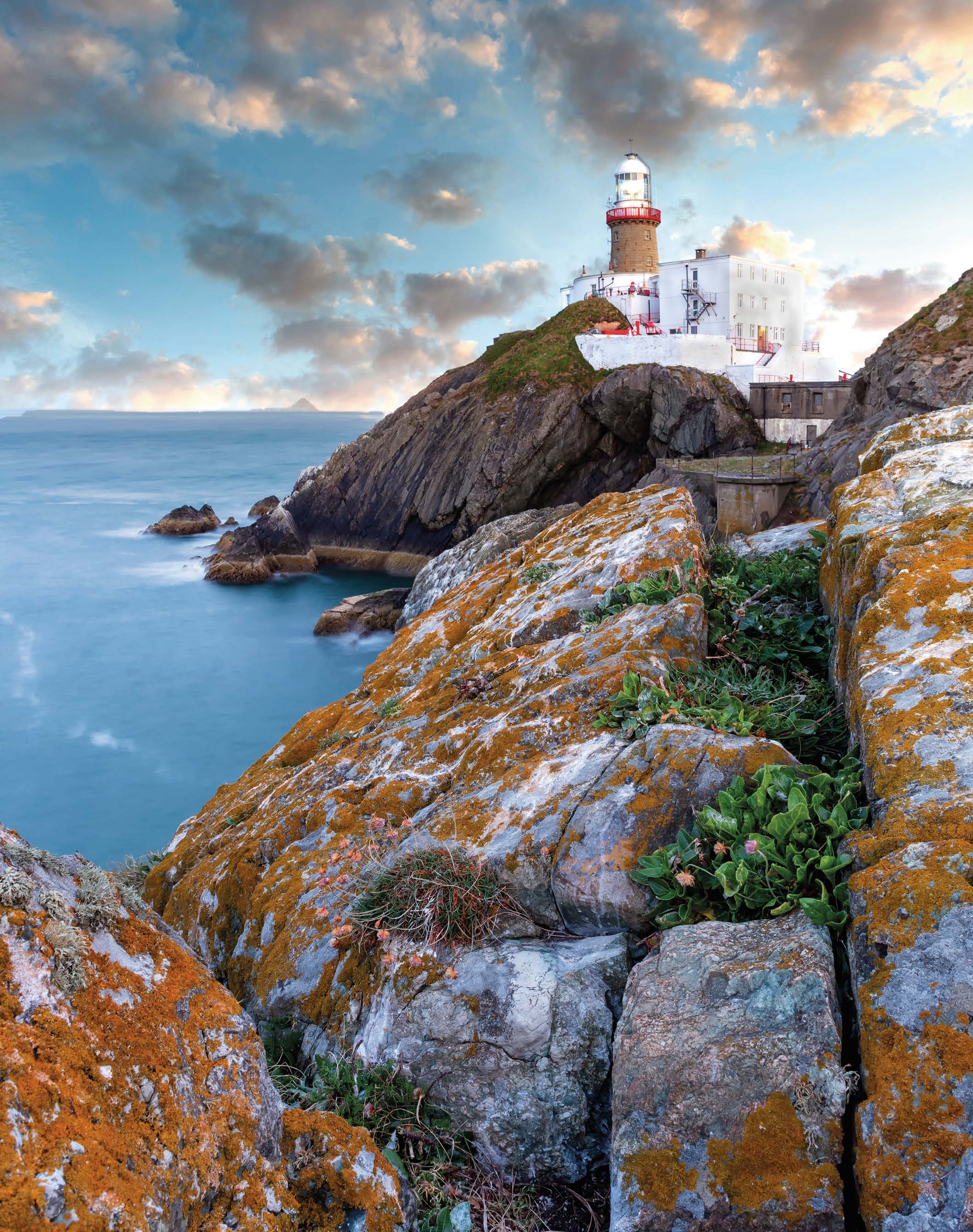
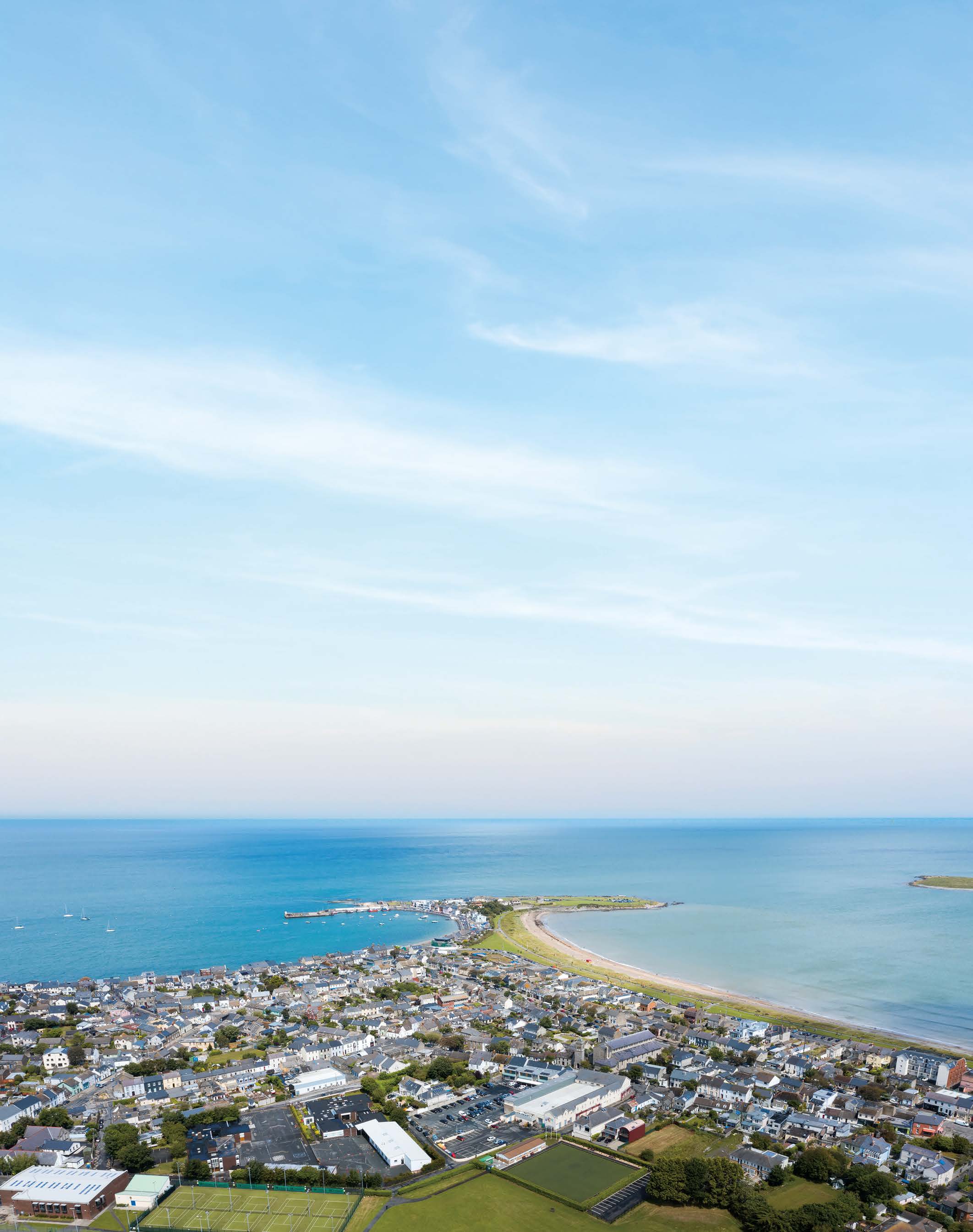
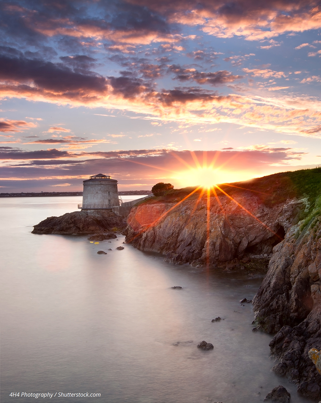
9.7 The Coast and Coastal Protection
Fingal’s coastline extends from Kilbarrack Stream in the south of the County to the Delvin River located north of Balbriggan. It is characterised by a series of shallow bays between headlands with a variety of inlets, islands, harbours, beaches and a number of protected areas of national and international importance. It is the single most important natural resource in the County. As well as being an economic resource for the fishing, leisure and tourism industries, the coastal area is significant in terms of cultural and archaeological heritage having been the focus of human settlement and activity for thousands of years. In addition, significant portions of the coastline are visually sensitive as evidenced by the many protected views and prospects, high amenity zonings and areas of exceptional landscape value which are highly sensitive to development. It is important that the coast is managed and developed in a way which protects and enhances its natural and cultural heritage and its landscape. The future economic, tourism, recreational and energy resource potential of the coast will need to be balanced with the requirement to protect its natural heritage, water quality and attractions.
The National Marine Planning Framework was published in July 2021 in accordance with EU Directive 2014/89/EU. It sets out a national strategy for the strategic planning and sustainable development in the maritime area for the purpose of achieving ecological, economic and social priorities (managing marine assets). Common terrestrial / marine policy areas include renewable energy, electricity networks, coastal and flood defences, fishing and aquaculture, ports and harbours, public access, tourism and recreation, protected sites and species, seascape and landscape. Development proposals must avoid significant reduction in the distribution and net extent of important habitats and other habitats that important species depend on, including avoidance of activity that may result in disturbance or displacement of habitats.
The coast is an ever-changing dynamic environment, subject to the continuous natural processes of erosion and deposition. While erosion is a normal occurrence in coastal areas, rates of erosion may be accelerated due to storm action, inappropriate development, pressures from leisure or recreational activities or the presence of man-made protection works. In addition, the impacts of predicted sea level rise and increase in the frequency of storm surges and high tides due to climate change need to be considered. It is recognised that defending long stretches of soft shoreline from erosion and coastal flooding may become technically and economically unsustainable in the future as a result of these climate change conditions.
There are broadly two approaches to dealing with coastal erosion and coastal flooding: providing engineered coastal defence structures or applying coastal adaptation strategies. The provision of engineered coastal defence structures can be divided into soft and hard engineering approaches. The soft engineering approach uses ecological principles and practices, which support the natural process of erosion and deposition, to maintain and enhance natural systems (such as sand-dunes, beaches, salt marshes, mudflats). In essence soft engineering uses existing habitats and vegetation to soften the land-water interface while maintaining the integrity of the shoreline. Hard engineering, on the other hand, is generally defined as controlled disruption of natural processes by using man-made structures. As the cost of hard engineering structures and their maintenance is high, such solutions are normally confined to densely populated locations where it is considered necessary to protect significant public infrastructure. In addition, the provision of hard defences can alter patterns of deposition, erosion or sedimentation elsewhere along the coastline leading to unintended impacts elsewhere. These factors, together with the fact that there is little information on the dynamics of coastal processes in Fingal, suggest that the provision of hard defences should be restricted along the coast to the maximum extent possible.
Coastal adaptation allows natural processes to take place and for lands to flood or erode without intervention. This may be combined with the removal of structures that would be affected by flooding or erosion. This approach eliminates the need for coastal defence structures but does require sufficient space for the coastal processes to take place. Managed retreat is a step further whereby coastal protection measures are removed to allow for more coastal flooding and/or where it is no longer economically feasible to maintain the existing defence structures.
Managed retreat tends to create more attenuation space to deal with coastal flooding issues and it helps to provide a natural buffer against coastal erosion. Best practice in coastal zone management stipulates not to interfere with the coast and the coastal processes if at all possible. This is mainly due to the unforeseen consequences of protective measures on other parts of the coast and the costs associated with the installation and future maintenance of coastal protection structures.
|
Objective GINHO64 Coastal Erosion Where coastal erosion is considered a threat to existing properties, explore the technical and economic feasibility of coastal adaptation and coastal retreat management options |
|
Objective GINHO65 Coastal Defence Works Employ soft engineering techniques as an alternative to hard coastal defence works, wherever possible. |
|
Objective GINHO66 Identification of Coastal Protection Works Identify, prioritise and implement necessary coastal protection works subject to the availability of resources, whilst ensuring a high level of protection for natural habitats and features, and ensure due regard is paid to visual and other environmental considerations in the design of any such coastal protection works. |
|
Objective GINHO67 Erosion Risk Management Undertake erosion risk management studies for high-risk areas so that the long-term erosion risks to property can be clearly identified long before the risk may be expected to occur. |
|
Objective GINHO68 Coastal Erosion Policy Develop a coastal erosion policy for Fingal based on best international practice to outline how the Council will deal with existing properties at risk of erosion and how future coastal erosion problems will be managed having regard to national climate change legislation, mitigation and adaptation policies, and the need to protect the environment. |
9.7.1 New Development in Coastal Areas
Coastal development must take account of the changing and dynamic nature of the coast and the need for coastal protection as described above. The coastal zone is subject to growing pressures from increasing population and increasing and sometimes conflicting social, economic and recreational uses. As a general principle, development in coastal areas should be accommodated wherever possible in previously developed areas before consideration is given to development in greenfield sites.
In all cases proposals for coastal development must consider the need for coastal defence. Development will only be permitted where the Council is satisfied that the development will not add to the requirement, if any, for any coastal defence works in the area over the lifetime of the development. Provision must also be made for the retention of existing soft defences such as beaches, sand-dunes, salt marshes and estuary lands. Development should be set-back a sufficient distance from soft defences and erodible coastline to allow for natural processes, such as erosion and flooding, to take place in these areas. A number of areas of coastline at risk from coastal erosion have been identified in the County based on current information and experience (see Green Infrastructure Maps). In these areas there will be a presumption against new development unless it can be shown, based on best available scientific information, that the likelihood of coastal erosion over the lifetime of the development is minimal. This will ensure that no new development takes place in areas likely to be subject to coastal erosion in the future.
|
Policy GINHP30 Development and the Coast Protect the special character of the coast by preventing inappropriate development along the coast. |
|
Objective GINHO69 New Development and the Coast Prevent inappropriate development along the coast, particularly on the seaward side of coastal roads. New development for which a coastal location is required shall, wherever possible, be accommodated within existing developed areas. |
|
Objective GINHO70 Pattern of Coastal Development Strictly control the nature and pattern of development within coastal areas and ensure that it is designed and landscaped to the highest standards and sited appropriately so as not to detract from the visual amenity of the area. Development shall be prohibited where the development poses a significant or potential threat to coastal habitats or features, and/or where the development is likely to result in altered patterns of erosion or deposition elsewhere along the coast. |
|
Objective GINHO71 Prohibition of Coastal Development Prohibit development along the coast outside existing urban areas where such development could not be adequately safeguarded over the lifetime of the development without the need to construct additional coastal defences. |
|
Objective GINHO72 Development and Risk of Coastal Erosion Prohibit new development outside urban areas within the areas indicated on Green Infrastructure maps, which are within 100m of coastline at risk from coastal erosion, unless it can be objectively established based on the best scientific information available at the time of the application, that the likelihood of erosion at a specific location is minimal taking into account, inter alia, any impacts of the proposed development on erosion, or deposition. |
|
Objective GINHO73 National Marine Planning Framework Comply with the policies and objectives of the National Marine Planning Framework as it relates to the area between the mean high-water mark and the near shore with respect to the planning and resource management of the marine area. |
9.7.2 Coastal Tourism and Recreation
The coast is an established area of leisure and amenity. Coastal areas have great potential for tourist related projects which could generate sustainable employment opportunities. These include land- based activities such as walking and cycling on the Fingal Coastal Way and water-based activities such as bathing, kayaking, surfing, kite-boarding and angling all along the Fingal coast. The infrastructure associated with such activities can conflict with the sensitive nature of the coast. In addition, motorised forms of water sports, such as power boating, raise particular concerns in terms of interference with the enjoyment of coastal amenities by other members of the public and can lead to adverse impacts on the natural heritage. It will be necessary to identify locations on the coast where these activities can be catered for without being in conflict with other objectives or contrary to the proper planning and sustainable development of the area. The Council recognises that these activities require a coastal location but need to be controlled and directed appropriately in view of the sensitive nature of the coast.
|
Policy GINHP31 Coastal Recreation Encourage leisure and amenity type uses along the coast so long as such uses do not cause significant adverse impacts on the environment, visual amenity and heritage. |
|
Policy GINP32 Coastal and Harbour Access Enhance and promote access to the coast and harbours, including the promotion of coastal and harbour recreational facilities where appropriate, while also prioritising protecting the coastal environment. |
|
Objective GINHO74 Coastal Way Plan and develop the Fingal Coastal Way from north of Balbriggan to Kilbarrack taking full account of the need to protect the natural and cultural heritage of the coast and the need to avoid significant adverse impacts on European Sites, other protected areas and species protected by law. |
|
Objective GINHO75 Coastal Access and Appropriate Assessment Ensure that there is appropriate public access to the coast including the provision of coastal walkways and cycleways, while taking full account of the need to conserve and enhance the natural and cultural heritage of the coast and the need to avoid significant adverse impacts on European Sites and species protected by law, through Screening for Appropriate Assessment, and examine the designation of traditional walking routes thereto as public rights of way. |
|
Objective GINHO76 Appropriate Leisure Facilities Encourage the development of facilities for maritime fishing and leisure developments where the siting of such installations and their supporting infrastructure will not have a significant adverse impact on the natural or cultural heritage or detract from the visual amenity and environmental quality and stability of an area, or public access to beaches. |
|
Objective GINHO77 Protection of Beaches Protect beaches, and bathing areas as valuable local amenities and as a tourism resource and support the maintenance, protection and improvement of access to them. |
|
Objective GINHO78 Protection of Bathing Waters Protect bathing waters, including those listed in the Water Framework Directive Register of Protected Areas for the Eastern River Basin District, at Sutton, Portmarnock, Malahide, Donabate, Portrane, Rush, Loughshinny, Skerries and Balbriggan in order that they meet the required bathing water standards and implement the findings and recommendations of the Quality of Bathing Water in Ireland reports as published. |
9.7.3 The Islands
There are a number of islands in Fingal, namely Lambay Island, Ireland’s Eye, Shenick Island, Colt Island, St. Patrick’s Island and Rockabill. Lambay Island is the only inhabited island. All of the islands are zoned as High Amenity Areas and they are all designated nature conservation sites of national or international importance. They are also of importance from an archaeological and architectural heritage viewpoint.
|
Policy GINHP33 Protection of the Islands Protect and enhance the special landscape character and exceptional landscape value of the islands, including their biodiversity, archaeological and architectural heritage. |
9.7.4 Dublin Bay Biosphere Reserve
Biosphere Reserves are places where nature and people connect. They are areas which are internationally recognised for their biological diversity yet also actively managed to promote a positive relationship between people and nature. The Dublin Bay Biosphere Reserve is a special designation awarded by the United Nations Educational, Scientific and Cultural Organisation (UNESCO). It is part of a global network of 651 Biosphere Reserves in 120 countries. The Biosphere extends to over 300 sq km, with over 300,000 people living within the newly enlarged Biosphere. The Biosphere designation does not add or detract from the regulatory framework already in place to protect Dublin Bay but encourages cooperation between the many stakeholders from across the bay to manage this natural amenity resource on Dublin’s doorstep in a sustainable manner.
The Biosphere is managed by the Dublin Bay Biosphere Partnership which includes Fingal County Council, Dublin City Council, Dun Laoghaire-Rathdown County Council, Dublin Port Company, Failte Ireland, National Parks and Wildlife Service and local community groups and NGOs. The partnership is working to promote the protection of habitats and species, to support education and research within the site and to support a sustainable economy for people living and working in the area.
|
Policy GINHP34 Dublin Bay Biosphere Partnership Participate in and actively support and contribute to the work of the Dublin Bay Biosphere Partnership. |
|
Objective GINHO79 Dublin Bay Biosphere Nature Conservation Strategy Support the implementation of the Dublin Bay Biosphere Nature Conservation Strategy, the Education and Awareness strategy and any other programs developed during the lifetime of this plan. |
Clár ábhair
Ábhair
Tráchtanna
Tráchtanna
Protecting the Royal Canal in Fingal
The Royal Canal is a unique navigable waterway in the heart of Dublin. Constructed before the invention of the locomotive, this historical stretch of waterway enabled the expansion of trade and...
NIS and SEA still has omissions
Please see the submission in full attached. if appendices do not attach they will be emailed to planning@fingal.ie before the deadline for onforwarding.
Increase the Riparian buffer along the Royal Canal to 30 metres
In 2008, FCC proposed to give the Royal Canal a development buffer of 200 metres, to protect this "unique and valuable amenity". This never materialised and it was only given 15 metres buffer from...
Biodiversity in Dublin 15
Biodiversity is hugely important, and the climate action elements are clear throughout the draft FDP.
I see a complete disconnect, however, between the emphasis on biodiversity and how FCC's...