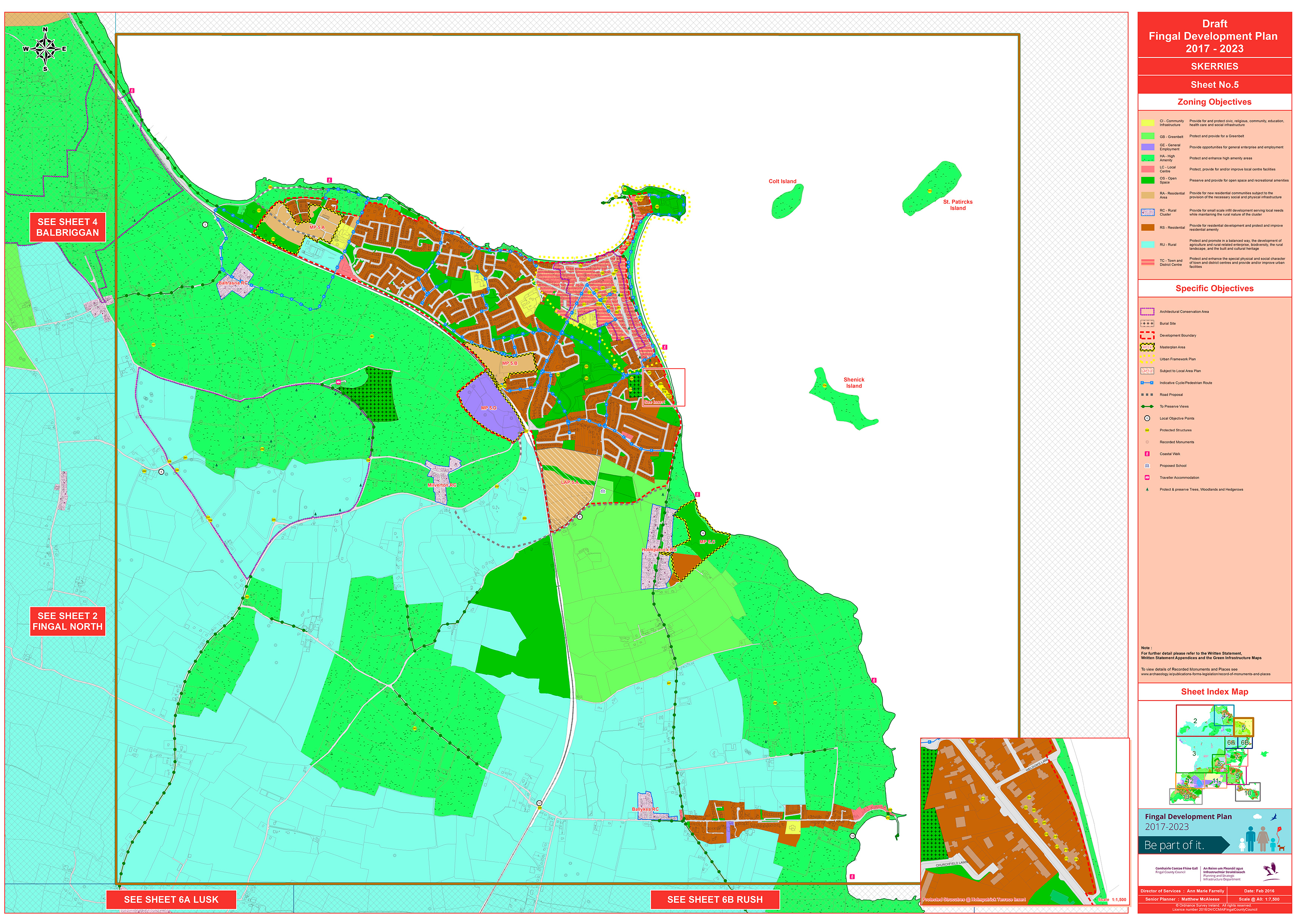
The map misspells ‘St Patricks Island’ as ‘St Patircks Island’. This should be corrected.
Map 5: Skerries
Closed19 Feb, 2016, 10:00am - 29 Apr, 2016, 5:30pm
Click on map to view high resolution version.
Contents
Materials
References
Observations
Observations
Walking and cycling access to Ardgillan
Map-based Objective 5 from Sheet 5 - Skerries - is:
Prepare a Recreational Strategy for Ardgillan Demesne with an emphasis on enhancing access
Chapter 3, Placemaking, of the...
Indicative Cycle/Pedestrian Routes
The Skerries map in the draft Development Plan has many blue lines for 'Indicative Cycle/Pedestrian Route' some of which do not correspond with local geography.
For example, an...
Distributor Road
Map 5 - Skerries - shows the gray dotted line for 'Road Proposal' for the extension of the distributor road to join the Balbriggan road and a gray dotted line for the section of the Balbriggan road...
Proposed LAP for Loughshinny
Proposed LAP for Loughshinny within the lifspan of the new Development Plan